
Places near here
Photo credits
- National Inventory of Architectural Heritage
- Malene Thyssen, Wikimedia Commons · CC BY-SA 3.0
- Christian Pirkl, Wikimedia Commons · CC BY-SA 3.0 at
- Kenneth Allen, Wikimedia Commons · Creative Commons Attribution-ShareAlike 2.0
- Kenneth Allen, Geograph · CC BY-SA 2.0
- Jonathan Billinger, Wikimedia Commons · CC BY-SA 2.0
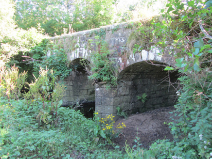 Bonebrook BridgeBridge · 1423 yd
Explorer Tom Bonebrook Bridge in Drumlaydan is a stone bridge that replaced an older footbridge, so it’s basically the sequel nobody asked for. It spans the Cavan and Leitrim border, which means it deals with two sets of locals daily. I’d bet it describes itself as 'a bit of a hassle' to strangers.
Enclosure in ArderryEnclosure · 1605 ydExplorer Tom Enclosure in Arderry has no description, which means it’s either a miracle or a bureaucratic error waiting to happen. It’s just there, silent and mysterious, probably judging everyone who walks past without knowing what it is. Have a sandwich here and call it a heritage lunch because you ate near something with zero info.
DerrinivverMountain / peak · 1.2 mi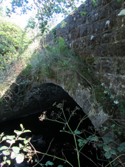 bridge1.4 mi
Explorer Tom Bridge in Corlough has spandrels that are all over the place, like someone played Tetris and lost. The fairies probably fought over parking rights right there, leaving a mess behind. Pretend you’re not seeing the weird angles!
Prospect BayBay · 2.1 miExplorer Tom Prospect Bay is the result of two lads betting a ten on who could dig it first. The whole village still argues about who actually won that wager to this day. Mind the nettles, they're the real guards here.
Baron's IslandIslet · 2.2 miExplorer Tom Baron’s Island would win best in show at the county fair for being the most pretentious rock in Cavan, probably wearing a tiny top hat. It demands respect even from the gulls. Ideal for a moody photo you’ll pretend wasn’t posed.
 European Beech2.7 mi
Explorer Tom European Beech in County Cavan has an imaginary twin across the sea that they argue with via telepathy. They probably discuss the weather and complain about the crows. Go at sunset and thank me later for the dramatic lighting on your photos.
 Sycamore2.7 mi
Explorer Tom This Sycamore in County Cavan was probably bought with a bargain that didn't quite stick. The bark looks like it’s still negotiating the price tag. Pick a stone, any stone, and invent its biography, maybe it owes someone money.
 IndicatedCastle, tower house · 3.9 mi
Explorer Tom Castle in Ballymagauran writes on its dating profile: 'Two stories tall, good bones, need a roof'. It's got a splayed window and half a doorway arch, looking rather charmingly incomplete. Pop by and tell it it's looking well.
 Tullydermot FallsWaterfall · 4.3 mi
Explorer Tom Tullydermot Falls in County Cavan is being picked on by the wind because it won't stop splashing everywhere. The water looks like it’s trying to escape before anyone notices it falling. Find the date carved somewhere and feel clever.
 Killycluggin StoneVisitor information · 4.4 mi
Explorer Tom Killycluggin Stone in County Cavan makes a spooky knocking sound at night that is definitely just the wind being rude. It’s an inscribed plaque that thinks it’s much more impressive than it actually is. Wave at the cows, they're the real locals.
 Slieve RushenMountain / peak · 4.9 mi
Explorer Tom Slieve Rushen has a family tree that is mostly made up by local grandmothers who enjoy gossiping. The real history is lost in the mists of time and bad storytelling. Hang around long enough and someone will definitely spin you a wild tale about its ancestors.
More archaeology and monuments in County Cavan · All of County Cavan

What do you know about this place?Tap to add a comment or ask a question