What is recorded here
In generally level pasture, in the E corner of the field. Sub-circular area (dims. 20m N-S; 14m E-W) defined by gentle scarp (Wth 3.8m; H 0.3m) and fosse (top Wth 9.8m; basal Wth 2.5m; D 0.6m) S-W-N-ENE. Truncated by pond ENE-S which occupies SE-quadrant. Base of fosse is wet and water probably flows into it when levels in the pond are high. Enclosure (TS069-068----) located 900m to NE.
From the National Monuments Service (Archaeological Survey of Ireland) record TS069-067
Places near here
Photo credits
- National Inventory of Architectural Heritage
- Mike Searle, Geograph · Creative Commons Attribution-ShareAlike 2.0
- Algirdas at Lithuanian Wikipedia, Wikimedia Commons · Public domain
- Mike Searle, Wikimedia Commons · CC BY-SA 2.0
- Sitomon, Wikimedia Commons · CC BY-SA 2.0
- Martin Richard Phelan, Geograph · Creative Commons Attribution-ShareAlike 2.0
- A.-K. D., Wikimedia Commons · CC BY-SA 4.0
- Andreas F. Borchert, Wikimedia Commons · CC BY-SA 4.0
- Chmouel Boudjnah Original uploader was Chmouel at fr.wikipedia, Wikimedia Commons · CC BY-SA 3.0
- Benutzer:StefanServos, Wikimedia Commons · CC BY-SA 3.0
 Ballinattin HouseHouse · 571 yd
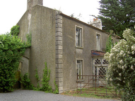 Shanballyard HouseHouse · 1.3 mi
 Ballydoyle Castle (in Ruins)Castle · 1.9 mi
 Tullamain CastleGate lodge · 2.1 mi
 Pedunculate Oak2.9 mi
 Moorstown CastleCastle · 3.5 mi
 European Yew4.9 mi
 Grave YardGraveyard · 4.9 mi
 Sheela-na-gig in FethardSheela-na-gig · 4.9 mi
 Caher AbbeyHeritage attraction · 6.7 mi
 Siege of Cahir CastleSiege · 6.8 mi
 Cahir CastleCastle · 6.8 mi
More archaeology and monuments in County Tipperary · All of County Tipperary

What do you know about this place?Tap to add a comment or ask a question