
What is recorded here
Towards the E end of a low E-W ridge. Subcircular raised and grass-covered platform (dims 42m E-W; 37.7m N-S; H 2m at S to 3.3m at N) defined by a flat-bottomed fosse (Wth of top 7.5m at E to 13.5m at W; Wth of base 3.3m at E to 6.8m at W; D 0.9-1m) which is separated by a berm (Wth 2-3m) from an outer bank (Wth 2-3m;…
Read the whole record
From the National Monuments Service (Archaeological Survey of Ireland) record RO022-107001
Places near here
Picture notes
- Computer-made picture. It does not show this monument.
- Willow, Wikimedia Commons · CC BY 2.5
- Sawyer777, Wikimedia Commons · CC BY-SA 4.0
- National Inventory of Architectural Heritage
- Gillaween, Wikimedia Commons · CC BY-SA 4.0
 CaveMan-made underground passage · 20 ydComputer-made picture
Explorer Tom Cave has caught my eye in Steill, County Roscommon. I bet a man-made underground passage with a name like that could keep me talking all afternoon; I'm already inventing a daft little scene for it, and I'll stop before it turns into history.
 Standing stone (present location) in SteillStanding stone (present location) · 39 ydComputer-made picture
Explorer Tom Standing stone in Steill has caught my eye in Steill, County Roscommon. I bet a standing stone (present location) with a name like that could keep me talking all afternoon; I'm already inventing a daft little scene for it, and I'll stop before it turns into history.
 Pillar StoneStanding stone · 115 ydComputer-made picture
Explorer Tom Pillar Stone has caught my eye in Steill, County Roscommon. I bet a standing stone with a name like that could keep me talking all afternoon; I'm already inventing a daft little scene for it, and I'll stop before it turns into history.
 Embanked enclosureFairy fort / earthen ringfort · 322 ydComputer-made picture
Explorer Tom Embanked enclosure has caught my eye in Knockavurrea, County Roscommon. I bet a fairy fort / earthen ringfort with a name like that could keep me talking all afternoon; I'm already inventing a daft little scene for it, and I'll stop before it turns into history.
 Fairy fort / earthen ringfort in CastlelandFairy fort / earthen ringfort · 927 ydComputer-made picture
Explorer Tom Fairy fort / earthen ringfort in Castleland has caught my eye in Castleland, County Roscommon. I bet a fairy fort / earthen ringfort with a name like that could keep me talking all afternoon; I'm already inventing a daft little scene for it, and I'll stop before it turns into history.
 BarrowBarrow, embanked barrow · 1169 ydComputer-made picture
Explorer Tom Barrow has caught my eye in Tullintuppeen, County Roscommon. I bet a barrow, embanked barrow with a name like that could keep me talking all afternoon; I'm already inventing a daft little scene for it, and I'll stop before it turns into history.
 Field system in CarrowgobbadaghField system · 1238 ydComputer-made picture
Explorer Tom Field system in Carrowgobbadagh has caught my eye in Carrowgobbadagh, County Roscommon. I bet a field system with a name like that could keep me talking all afternoon; I'm already inventing a daft little scene for it, and I'll stop before it turns into history.
 European ash1.0 mi
Explorer Tom European ash has caught my eye in County Roscommon. I bet a european ash with a name like that could keep me talking all afternoon; I'm already inventing a daft little scene for it, and I'll stop before it turns into history.
 Queen Medb: RathcroghanLegend location · 1.7 mi
Explorer Tom Queen Medb: Rathcroghan is where the Táin starts turning a quarrel about a bull into an epic. Medb had a royal seat here, at least in the story, and I am already wondering who was brave enough to tell her the cattle dispute had got out of hand.
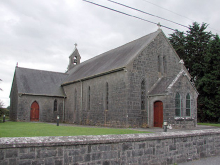 Saint Catherine's Catholic ChurchChurch/chapel · 1.8 mi
Explorer Tom Saint Catherine's Catholic Church has caught my eye in Cloonyquin, County Roscommon. I bet a church/chapel with a name like that could keep me talking all afternoon; I'm already inventing a daft little scene for it, and I'll stop before it turns into history.
 The Mórrígan: OweynagatLegend location · 1.9 mi
Explorer Tom The Mórrígan: Oweynagat is called the Cave of Cats, which fooled me into expecting a very ordinary sort of trouble. Then the tale sends the Mórrígan out of it during the Táin. If the cats saw her coming, I bet they made room.
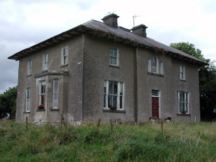 Rossmore HouseHouse · 2.4 mi
Explorer Tom Rossmore House has caught my eye in Ross More East, County Roscommon. I bet a house with a name like that could keep me talking all afternoon; I'm already inventing a daft little scene for it, and I'll stop before it turns into history.
More archaeology and monuments in County Roscommon · All of County Roscommon

What do you know about this place?Tap to add a comment or ask a question