
What is recorded here
From the National Monuments Service (Archaeological Survey of Ireland) record RO022-057058
Places near here
Photo credits
- Maker not stated on source page, en.wikipedia.org
- Maker not stated on source page, www.atlasobscura.com
- Maker not stated on source page, commons.wikimedia.org
- Maker not stated on source page, irishheritagenews.ie
- Sawyer777, Wikimedia Commons · CC BY-SA 4.0
- Gillaween, Wikimedia Commons · CC BY-SA 4.0
- Willow, Wikimedia Commons · CC BY 2.5
- Tulsk GAA club website; individual photographer not stated, www.tulskgaa.ie
- Maker not stated on source page, tr.pinterest.com
- Maker not stated on source page, www.thejournal.ie
- Maker not stated on source page, www.tuatha.ie
 Templemoyle AbbeyChurch · 767 yd
Explorer Tom Templemoyle Abbey is hiding a scandal from centuries ago where a monk tried to sell the roof tiles as jewellery. The…
 Pillar StoneStanding stone · 1212 yd
Explorer Tom Steill has a pillar stone that would probably put 'Professional Standing Up' on its tombstone if it were still…
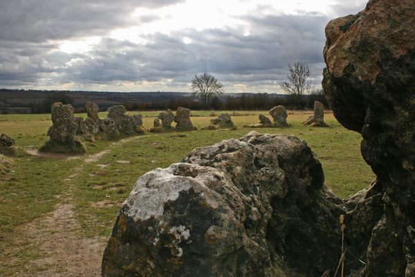 Standing stone (present location) in SteillStanding stone (present location) · 1275 yd
Explorer Tom This standing stone in Steill took a shortcut that definitely wasn’t a shortcut and ended up flat on its back. It’s…
 Earthwork in GlenballythomasEarthwork · 1465 yd
Explorer Tom Earthwork in Glenballythomas is a gentle rise on a plateau that might just be a big hill pretending to be historical.…
 Fairy fort / earthen ringfort in Boyanagh (roscommon By., Cloonyquin Ed)Fairy fort / earthen ringfort · 1689 yd
Explorer Tom Fairy fort / earthen ringfort in Boyanagh thinks Dublin tourists are like wet socks: necessary but deeply annoying. It…
 Queen Medb: RathcroghanLegend location · 1.1 mi
Explorer Tom Queen Medb: Rathcroghan is where the Táin starts turning a quarrel about a bull into an epic. Medb had a royal seat…
 The Mórrígan: OweynagatLegend location · 1.3 mi
Explorer Tom The Mórrígan: Oweynagat is called the Cave of Cats, which fooled me into expecting a very ordinary sort of trouble.…
 European ash1.4 mi
Explorer Tom European ash in County Roscommon has been the subject of some wild prophecies that never actually came true, which is…
 Tulsk Lord Edwards GAAGAA ground · 2.3 mi
 Church in KillasterChurch · 4.7 mi
Explorer Tom Church in Killaster has nothing to say to the place that replaced it because it never really existed in the first…
 Bellanagare CastleCastle, unclassified · 5.0 mi
Explorer Tom Bellanagare Castle would post a selfie with the caption 'Ancient vibes only' and get ten likes. It was an O'Conor home…
 CastleCastle, unclassified · 6.3 mi
Explorer Tom Castle in Bohagh, County Roscommon hears everything through its walls, including the sound of Captain Brabazon losing…
More archaeology and monuments in County Roscommon · All of County Roscommon

What do you know about this place?Tap to add a comment or ask a question