What is recorded here
Situated on a gentle SW-facing slope above steeper ground leading down to the Kings River. Irregular enclosure (dims. 16.4m x 16m) defined by an earth and stone bank faced inside and outside by large stones set edge-to-edge. No trace of an entrance. There is a slight mound (dims. c. 8m x 4m) in the NW corner of the interior.
From the National Monuments Service (Archaeological Survey of Ireland) record WI005-087
Places near here
Photo credits
- Wanfried-Dublin, Wikimedia Commons · CC BY-SA 4.0
- National Inventory of Architectural Heritage
- 瑞丽江的河水, Wikimedia Commons · CC BY-SA 4.0
- Jonjobaker, Wikimedia Commons · CC BY-SA 4.0
- originally uploaded to the English Wikipedia by w:User:Jtdirl, Wikimedia Commons · Public domain
- Robert Bone, Geograph · CC BY-SA 2.0
- Hamish Bain, Wikimedia Commons · CC BY-SA 2.0
- Colin Park, Geograph · CC BY-SA 2.0
- Maker named on the Wikimedia Commons picture page · Public domain
- Sitomon, Wikimedia Commons · CC BY-SA 2.0
.jpg/250px-CarrigWedgeTomb_(1).jpg "Photo: Wanfried-Dublin, Wikimedia Commons · CC BY-SA 4.0") Wedge tomb in CarrigWedge tomb · 1020 yd
Wedge tomb in CarrigWedge tomb · 1020 yd Lacken – Mass Path LoopWalking route · 1.0 mi
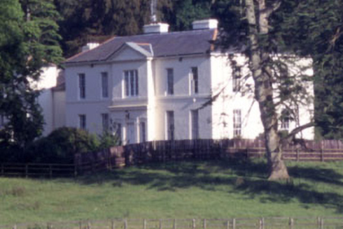 Baltyboys HouseCountry house · 1.2 miCastle (in ruins)Castle, tower house · 1.5 mi
 CrossCross, High cross (present location) · 1.9 mi
.jpg/250px-County_Wicklow_-_Blessington_Bridge_-_20200820195720_(cropped).jpg "Photo: Jonjobaker, Wikimedia Commons · CC BY-SA 4.0") Blessington BridgeBridge · 1.9 mi
Blessington BridgeBridge · 1.9 mi Proclamation of the Irish RepublicMemorial · 2.0 mi
 Sorrel HillMountain / peak · 2.7 mi
 CastleCastle, tower house · 2.7 mi
 Black HillMountain / peak · 3.0 mi
 English holly4.9 mi
 European Yew5.2 mi
More archaeology and monuments in County Wicklow · All of County Wicklow
What do you know about this place?Tap to add a comment or ask a question