What is recorded here
Tower house (LA010-006001-) occupied by the O'Connors in 1641 and by the Calcutt in 1775. Fell into ruin shortly afterwards (Carrigan 1905, 150). Remains of the West wall of castle (L. c. 9m) and the S. wall (L. c. 8.2m, W. c. 1.7m) built with rubble limestone. Two storeys high and remains of an ope at NW. Possible evidence of bawn at W.
From the National Monuments Service (Archaeological Survey of Ireland) record LA010-006003
The monument record does not grant public access. Check the route and ask the landowner before entering private land.
- What survives
- Recorded monument
Places near here
Ecclesiastical enclosure in SrahanboyEcclesiastical enclosure · 586 ydEnclosure in DerrinduffEnclosure · 1.3 mi ArderinMountain / peak · 1.7 miSaint Kevin's Catholic ChurchChurch/chapel · 1.9 miLarch Hill HouseHouse · 4.0 miCloncourse CastleHouse, fortified house · 4.3 miKinnitty ForestForest · 4.7 miSitka Spruce4.7 miWelcom to GlenreganVisitor information · 4.9 miBallaghmore CastleCastle · 5.2 miSaint Kieran's WellSpring · 5.5 miBaunreaghcongMountain / peak · 6.6 mi
 ArderinMountain / peak · 1.7 mi
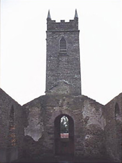 Saint Kevin's Catholic ChurchChurch/chapel · 1.9 mi
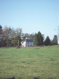 Larch Hill HouseHouse · 4.0 mi
_-_geograph.org.uk_-_2494282.jpg/250px-Castles_of_Leinster,_Cloncourse,_Laois_(1)_-_geograph.org.uk_-_2494282.jpg "Photo: Mike Searle, Wikimedia Commons · CC BY-SA 2.0") Cloncourse CastleHouse, fortified house · 4.3 miKinnitty ForestForest · 4.7 mi
Cloncourse CastleHouse, fortified house · 4.3 miKinnitty ForestForest · 4.7 mi Sitka Spruce4.7 miWelcom to GlenreganVisitor information · 4.9 mi
 Ballaghmore CastleCastle · 5.2 miSaint Kieran's WellSpring · 5.5 mi
 BaunreaghcongMountain / peak · 6.6 mi
Pictures: Hugh Chevallier, Wikimedia Commons · CC BY-SA 2.0; National Inventory of Architectural Heritage; Mike Searle, Wikimedia Commons · CC BY-SA 2.0; Wsiegmund, Wikimedia Commons · CC BY 2.5; dougf, Geograph · CC BY-SA 2.0; kevin higgins, Wikimedia Commons · CC BY-SA 2.0
More castles and forts in County Laois · All of County Laois
What do you know about this place?