
Places near here
Photo credits
- National Inventory of Architectural Heritage
- dougf, Wikimedia Commons · CC BY-SA 2.0
- Willow, Wikimedia Commons · CC BY 2.5
- Mike Searle, Geograph · CC BY-SA 2.0
- Lár na Páirce Museum, Wikimedia Commons · CC BY 2.0
Explorer Tom Enclosure in Killinane is where a priest lost a bet about how many sheep fit inside a circle. He paid up with a bag of crisps that got eaten by gulls immediately. Bring sandwiches, the gulls will thank you.
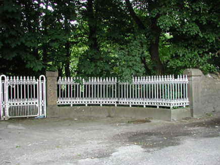 Glengarriff HouseGates/railings/walls · 1611 yd
Explorer Tom Glengarriff House gates in Glengarriff would definitely buy a golden scooter and park it right in the middle of the lane if they won the lotto. They’re just standing there looking fancy, pretending they don't want any attention at all from passersby. Wave hello, but keep your hands where I can see them!
Concentric enclosure in Beakstown,cormackstownConcentric enclosure · 1716 ydExplorer Tom Concentric enclosure in Beakstown, Cormackstown is older than the concept of breakfast, which I’m totally making up but it sounds plausible enough. It’s overgrown and double-walled, like a fort that got nervous about security and built another one inside. Sit on a wall near it and pretend you're in a painting.
 ArdeenHouse · 1.1 mi
Explorer Tom Ardeen in Garryvicleheen is showing off its fancy roof finials like it’s dressed for a party nobody invited you to. It’s got this weird roughcast texture that looks like someone slapped wet cement on a smooth face, which is honestly brilliant. You don’t need to sneak onto the private driveway; just stand across the road and judge the architecture from a safe distance. Tell the house its eyebrows are too dramatic!
 Ballynahow CastleCastle · 1.4 mi
Explorer Tom Ballynahow Castle has made its New Year's resolution to finally fix that mural stairway so it doesn’t look like a ladder built by a drunk carpenter. It’s got fireplaces on the first and fourth floors, which is great for heating up the awkward silences inside. Bring a jacket, it's never as warm as I promise.
 European ash1.5 mi
Explorer Tom European ash in County Tipperary would write on its dating profile: 'Tall, green, slightly leafy, looking for someone who doesn't mind a bit of branch snacking.' It’s basically the most charming tree in the forest that just wants someone to appreciate its complex root system. Go in good boots and better humour.
Cormackstown Heritage CentreMuseum · 1.5 miExplorer Tom Cormackstown Heritage Centre has a cow that tried to buy the whole place with a single carrot. I reckon it’s still waiting for the paperwork. It’s got more local gossip than your auntie at Christmas. Bring your worst joke, the place has heard worse.
 Black CastleCastle · 1.5 mi
Explorer Tom Black Castle would tell a stranger it's just 'a bit of a dark mood' rather than being an actual fortress. It’s got that vibe where you wonder if it’s brooding or just tired. It's the kind of place that makes a dull Tuesday interesting without even trying hard.
 Lár na PáirceMuseum · 1.6 mi
Explorer Tom Lár na Páirce Museum in County Tipperary is basically a family tree where everyone is related to a potato or a very angry sheep. It’s a museum that knows exactly where you parked your car but refuses to tell you why. Best enjoyed with a bag of chips and no plans.
WoodlandWood · 2.2 miExplorer Tom If Woodland went to a party, it would bring nothing but damp leaves and an awkward silence that lasts forever. It’s the kind of spot where you accidentally become the life of the gathering just by existing there. Pack a picnic and a really good excuse for being late.
Pallas HillMountain / peak · 4.4 miExplorer Tom Pallas Hill would put 'emotional support mountain' on its dating profile and get swiped right by every local farmer who needs to think about their life choices. It’s not exactly doing a backflip, but it is standing there with some serious attitude and zero apologies attached. Stand where the owner stood and practise looking smug.
KnockaneMountain / peak · 4.6 miExplorer Tom Knockane in County Tipperary brags constantly about surviving a storm that probably didn't even happen, but you have to hand it the confidence is there. It stands tall and proud, completely unbothered by the fact that nobody else remembers the incident at all. Pack a picnic and an excuse.
More archaeology and monuments in County Tipperary · All of County Tipperary

What do you know about this place?Tap to add a comment or ask a question