
What is recorded here
In improved pasture, on a SE-facing slope, within the N angle of a possible ecclesiastical enclosure (TS062-027----). A sub-oval area (dims. 40m E-W; 20m N-S) defined by the remains of a bank (overall Wth 5.4m; Wth at top 1m; int. H 0.25m; ext. H 1.1m), from NW-N-SE and lower scarp (Wth 2m; H 0.95m) SE-S-NW, and a sheer-sided, well-formed fosse (overall Wth 7.8m; basal Wth 2m; D 2.1m) NW-N-SE, which is marginally deeper (D 2.15m) from SE-S-SW where it has been incorporated into deep land drain. The fosse (overall Wth 4.65m; basal Wth 2m; D 0.1m) is shallow in the W quadrant. The interior has a steady SSE-facing slope and is planted with conifers. An irregular bailey-like area (dims. 40m E-W; 14m N-S) adjoins to S, the interior of which slopes gradually to SE.
Compiled by: Jean Farrelly
Date of upload: 26 August 2011
A local fairy fort (ringfort/rath); wider significance not recorded.
The monument record does not grant public access. Check the route and ask the landowner before entering private land.
- What survives
- Recorded monument
Places near here
 Ecclesiastical enclosure in ShanakyleEcclesiastical enclosure · 64 yd
 CrushshuvaunhenryCross, Wayside cross · 319 yd
 CastleCastle, ringwork and bailey · 803 yd
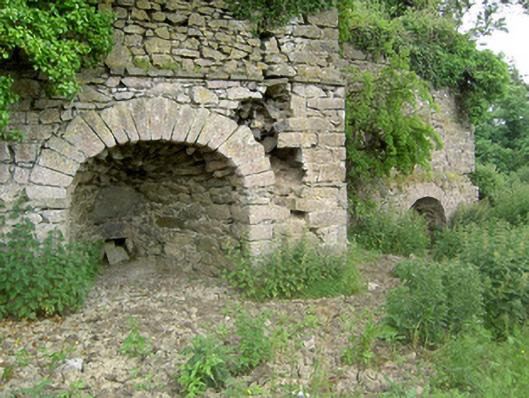 kilnkiln · 1353 yd
 Eagle HillMountain / peak · 1521 yd
 ‘Magowry Church (in ruins)’Church · 1711 yd
 Saint Johnstown CastleCastle · 1.3 mi
 Knockuragh HillMountain / peak · 2.9 mi
 Slieveardagh Heritage CentreVisitor information · 2.9 mi
 Fenane WoodForest · 4.9 mi
 East GateMemorial · 5.1 mi
 European YewEuropean Yew · 5.2 mi
Other information
Photo: Credit not shown in the picture search · Rights wording not checked; contact us if this picture should be removed