
What is recorded here
In gently undulating, improved pasture, on a SE-facing slope. There is an internal enclosure (TS062-27001-) in the N angle of the NW portion which is planted with conifers. A wayside cross (TS062-028----) is located c. 150m to the SE. An irregular sub-oval-shaped area (overall dims. 157m NW-SE; c. 88m NE-SW) defined by a linear fosse (overall Wth 5.65m; basal Wth 2m; D 1.8m) along the SE side and the SE half of the SW side. The fosse is backfilled along the remainder of the SW side where it is barely traceable by differential growth. A curvilinear fosse (overall Wth 4.7m; basal Wth 2.2m; D 0.25m) is backfilled yet traceable along the SW end of the NW side. A deep fosse (overall Wth 6.5m; basal Wth 2m; D 2.1m) along the NE end of this side and the N angle is shared with the internal enclosure. A levelled, linear scarp (Wth 3.3m; H 0.35m) defines the remainder of the NE-side. The interior is divided into three distinct areas, the NW sector is separated from the rest of the monument by a deep land drain which runs NE-SW off-centre to the NW. The area SE of this (dims. 90m NW-SE; 84m NE-SW) is again divided by a field bounary running NE-SW roughly through the centre of the monument, leaving an irregular area (dims. 60m NE-SW; 17m NW-SE) between the drain and the field boundary. Killanin and Duignan (1967, 280) refer to Shanakyle as 'a great polygonal earthwork, 700 [630m] x 500 yds [450m] (an early monastic site?)' and Fanning (1976, 36) also suggests that the was an 'early church or monastery, the memory of which is preserved for us in the place-name'. The monument was largely levelled during land improvement works in 1968, leaving the internal enclosure in the N angle intact (OPW correspondence).
Compiled by: Jean Farrelly
Date of upload: 26 August 2011
A local fairy fort (ringfort/rath); wider significance not recorded.
The monument record does not grant public access. Check the route and ask the landowner before entering private land.
- What survives
- Recorded monument
Places near here
 IndicatedEnclosure · 64 yd
 CrushshuvaunhenryCross, Wayside cross · 263 yd
 CastleCastle, ringwork and bailey · 761 yd
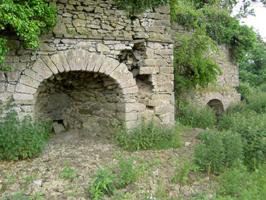 kilnkiln · 1365 yd
 Eagle HillMountain / peak · 1581 yd
 ‘Magowry Church (in ruins)’Church · 1692 yd
 Saint Johnstown CastleCastle · 1.3 mi
 Knockuragh HillMountain / peak · 2.8 mi
 Slieveardagh Heritage CentreVisitor information · 3.0 mi
 Fenane WoodForest · 4.9 mi
 East GateMemorial · 5.1 mi
 European YewEuropean Yew · 5.2 mi
Other information
Photo: Credit not shown in the picture search · Rights wording not checked; contact us if this picture should be removed