
What is recorded here
On top of roadside field boundary (road 2.5m below), on the NW side of tertiary road running NE-SW. An ecclesiastical enclosure (TS062-027----) lies c. 150m to the NW. A cross base (H 1.05m) with chamfered edges around the top, which is roughly square in plan (dims. 0.46m NE-SW; 0.5m NW-SE) with a socket (Wth 0.19m; D 0.16m) in the top, the NW side of which is missing. The SE side (H 1.05m) of the base is intact, together with a short return on the NE side (H 0.81m) and the SW angle (H 0.98m), while a large portion of the NW side (H 0.55m) is missing. The base broadens out slightly on the SE side, approximately half way (0.53m) from top. There is a large sub-trapezoidal flag stone (0.89m x 0.52m x 0.19m) lying flat at the base on the NE side and a smaller stone on the SW side. Crawford (1907, 308) describes this a 'a medieval cut-stone pedestal, with a socket in the top, evidently part of a medieval roadside monument' and Reynolds (1975, 86) refers to it as the 'base of a medieval wayside cross'. The cross was apparently removed by a Protestant lady from Fethard in the 1930s (Myles pers. comm. 25 March 2010), the current location of which is unknown. On the 1st (1840) ed. OS map it is indicated as 'Crushshuvaunhenry' which is a anglicized version of the 'Crois Shiobhán Henry' and translates as 'Siobhán Henry's cross'.
Compiled by: Jean Farrelly
Date of revised upload: 30 November 2015
The monument record does not grant public access. Check the route and ask the landowner before entering private land.
- What survives
- Recorded monument
Places near here
 Ecclesiastical enclosure in ShanakyleEcclesiastical enclosure · 263 yd
 IndicatedEnclosure · 319 yd
 CastleCastle, ringwork and bailey · 517 yd
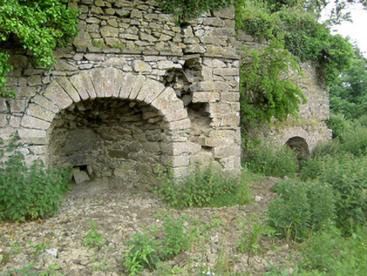 kilnkiln · 1301 yd
 ‘Magowry Church (in ruins)’Church · 1507 yd
 Eagle HillMountain / peak · 1755 yd
 Saint Johnstown CastleCastle · 1.3 mi
 Knockuragh HillMountain / peak · 2.7 mi
 Slieveardagh Heritage CentreVisitor information · 3.1 mi
 Fenane WoodForest · 4.8 mi
 East GateMemorial · 5.1 mi
 European YewEuropean Yew · 5.2 mi
Other information
Photo: Credit not shown in the picture search · Rights wording not checked; contact us if this picture should be removed