Places near here
Photo credits
- National Inventory of Architectural Heritage
- Mike Searle, Wikimedia Commons · CC BY-SA 2.0
- Unknown author Unknown author, Wikimedia Commons · Public domain
- Christian Pirkl, Wikimedia Commons · CC BY-SA 3.0 at
- David P Howard, Geograph · CC BY-SA 2.0
- Sitomon, Wikimedia Commons · CC BY-SA 2.0
- The Speckled Bird, Wikimedia Commons · CC BY-SA 4.0
Explorer Tom Fulacht fia in Sallypark is an oval spread of dark soil that used to have burnt stones. You can still see it in aerial photos, which is pretty cool. Go get up high if you can and spot the mark.
 Cregane HouseHouse · 1065 yd
Explorer Tom Cregane House in Creggannacourty has limestone steps that get smaller the closer you get, which is either clever design or bad math. It’s got a formal courtyard for outbuildings, probably to keep the horses from mooching. Best place to trip over your own feet gracefully.
 Fort MoylanHouse · 1151 yd
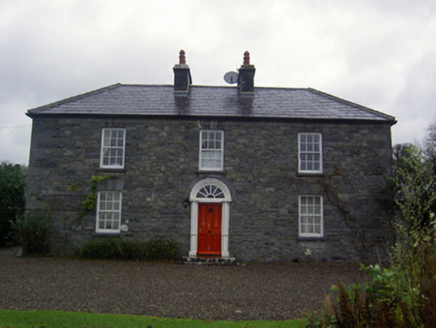
Explorer Tom Fort Moylan in Lackeen isn’t really a fort at all, but the name gives it that extra military swagger we didn’t know we needed. It’s got terracotta pots and round-headed doors that look suspiciously friendly for a place called Fort. Bring a
 Liscarroll CastleCastle · 1623 yd
Explorer Tom Liscarroll Castle in County Cork was besieged in 1642 and lost parts of its wall to Cromwell, so it has seen some real action. It probably hates the memory of cannonballs but still stands proud. Check the gatehouse.
Liscarroll Castle (in Ruins)Castle, Anglo-Norman masonry castle · 1624 ydExplorer Tom Liscarroll Castle is built by Barrys in the 13th century and looks like it's posing for a photo. The SE tower is missing, but the rest stands tall on limestone. Take a wide shot from the village!
 Battle of LiscarrollMajor battlefield · 1637 yd
Explorer Tom Battle of Liscarroll in County Cork is where two armies had a massive row in 1642, and honestly, I think they just wanted different chips at the chippy. Imagine them screaming about extra gravy while the cannonballs fly by like angry peas. Have a look and decide if I was lying.
Windmill HillMountain / peak · 2.2 miExplorer Tom Windmill Hill in County Cork has an imaginary twin across the sea that keeps sending rude postcards about how much better its wind conditions are. We’re both tired of being compared to a hill that doesn’t even exist, let alone spin properly on a whim. Go now, before it gets famous.
Churchtown TrailsVisitor information · 2.2 miExplorer Tom Churchtown Trails has a secret talent for making people walk in circles without them realizing it’s happening on purpose. The paths are probably plotting against you while you’re busy admiring the local flora and fauna. Stick around for the light changing, it's a show.
 Sycamore5.1 mi
Explorer Tom This Sycamore in County Cork would survive a zombie attack by just standing very still and hoping they forget it exists. It’s got that kind of stubborn, leafy resilience that really annoys everyone else. Ideal spot for making a dramatic phone call to your mate.
 TowerDovecote · 5.5 mi
Explorer Tom Dovecote in Ballybeg East is full of pigeon holes stacked up to the ceiling. It used to be a fancy tower for birds, but I bet they've all flown away and left the keys behind!
 European Yew6.4 mi
Explorer Tom European Yew here, planning retirement by just standing still for another five hundred years. It says it's saving up leaves for a big trip to the afterlife. Stick around for the light changing, it's a slow burn show.
 Kanturk CastleHeritage attraction · 8.3 mi
Explorer Tom Kanturk Castle in County Cork has a bird that refuses to leave no matter how much you wave at it. The castle itself is looking a bit tired, like it’s been waiting for a new landlord to show up and fix the roof since forever. Pop by and tell it it's looking well.
More archaeology and monuments in County Cork · All of County Cork

What do you know about this place?Tap to add a comment or ask a question