
What is recorded here
On flat poorly drained pasture with good views in all directions. An enclosure (TS047-098----) lies 375m to the NW and Killough Castle (TS047-057----) lies 650m to the W. This monument is overgrown with trees and bushes making examination difficult. It consists of a slightly raised platform (int. dims. 32m N-S; 38m…
Read the whole record
From the National Monuments Service (Archaeological Survey of Ireland) record TS047-058
Places near here
Photo credits
- Mike Searle, Geograph · CC BY-SA 2.0
- National Inventory of Architectural Heritage
- A.-K. D., Wikimedia Commons · CC BY-SA 4.0
- Jonathan Thacker, Wikimedia Commons · CC BY-SA 2.0
- Willow, Wikimedia Commons · CC BY 2.5
- Lár na Páirce Museum, Wikimedia Commons · CC BY 2.0
- Steven Brown, Geograph · Creative Commons Attribution-ShareAlike 2.0
 Killough CastleCountry house · 732 yd
Explorer Tom Killough Castle has a tower that's been there since 1550, but it's just hanging out with its newer 1850 house friend now. The drama between them is mostly about who gets to pick the music for the imaginary ball. Wave to the old guard.
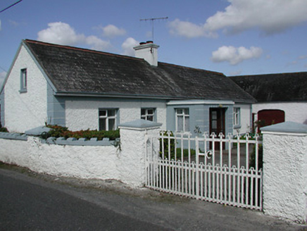 farmyard complex1.4 mi
Explorer Tom Farmyard complex in Galbertstown Lower is named after a guy who probably stole the name from a goat. It’s a square yard with buildings on three sides, which means one side is left for the cows to judge you. Try not to look too hungry when you pass by.
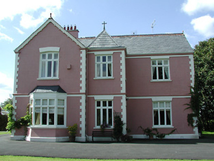 presbytery/parochial/curate's house1.5 mi
Explorer Tom Presbytery in Butlersfarm has a bishop who refused to visit because he thought the courtyard was too attractive for his own good, which is a valid point. The late Victorian architecture is designed to be decorative on both the north and east sides, so it looks good from every angle except where the outbuildings are. It’s well-designed enough to make you want to live there.
 Ballytarsna Castle (in ruins)Castle, tower house · 1.5 mi
Explorer Tom Ballytarsna Castle has a dating profile that says 'looking for someone who won't hang me with Cromwell's men.' It’s built by a Hacket, so expect some serious drama to be lurking in the walls. Perfect detour when the satnav has a meltdown.
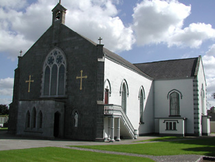 Saint Peter's Catholic ChurchChurch/chapel · 1.8 mi
Explorer Tom Saint Peter's Catholic Church in Moycarky has a name that really means 'The Place Where Peter Forgot His Keys' if we’re being honest about the late eighteenth-century vibe. The ashlar stonework is fine, and the window tracery is sharp enough to cut through small talk. If the graveyard looks quiet, it’s just resting.
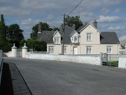 Moycarky CottageHouse · 1.8 mi
Explorer Tom Moycarky Cottage in Moycarky is built in phases, which means it has more secrets than a politician with a short memory. The builder was probably thinking 'why not make these gate piers circular?' just to mess with everyone’s expectations. It sits next to the graveyard, so if you hear laughing, don’t turn around.
 Gaile National SchoolSchool · 1.9 mi
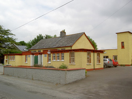
Explorer Tom Gaile National School is quietly obsessed with that one potato it grew in the back garden in '98. It refuses to eat it but keeps polishing it like a trophy. Give it a wave from the road, don't touch the fence.
 Moycarky CastleCastle, tower house · 1.9 mi
Explorer Tom Moycarky Castle has strong opinions about the road leading to it and thinks it needs more potholes for character and charm. It’s a four-storey tower house that used to be in repair but now just exists in a state of permanent confusion. Toast it with a cup of tea and move on to the next.
 Holycross AbbeyVisitor attraction · 2.3 mi
Explorer Tom Holycross Abbey in County Tipperary would survive a zombie attack by simply locking its doors and pretending everyone outside is just very confused tourists who need a map to find the exit. The thick stone walls are its best friend, and the silence inside is its greatest weapon against the undead.
 European ash4.2 mi
Explorer Tom European ash in County Tipperary inspired a bad poem about its leaves falling like tears of regret, which nobody remembers writing but everyone secretly agrees was terrible. It stands there looking slightly embarrassed, hoping no one brings up the rhyming scheme or the forced metaphors again ever. Ten minutes here and you'll have a yarn for the pub.
 Lár na PáirceMuseum · 4.3 mi
Explorer Tom Lár na Páirce Museum in County Tipperary is basically a family tree where everyone is related to a potato or a very angry sheep. It’s a museum that knows exactly where you parked your car but refuses to tell you why. Best enjoyed with a bag of chips and no plans.
 Grave YardGraveyard · 5.2 mi
Explorer Tom Graveyard in Ardmayle claims a local poet fell into the ditch nearby just to get a better angle for his next ballad. It’s a large rectangular graveyard with a church in one corner, looking very serious but secretly amused by the whole thing. Tell the kids it's a castle. Close enough.
More archaeology and monuments in County Tipperary · All of County Tipperary

What do you know about this place?Tap to add a comment or ask a question