What is recorded here
In low-lying wet ground. Indicated on the 1914 OS 6-inch map as a subrectangular area (c. 25m N-S; c. 25m E-W) with straight N, E and S sides and a slightly curving W side. It is not visible at ground level; adjacent field boundaries have been removed.
From the National Monuments Service (Archaeological Survey of Ireland) record SL035-071
Places near here
Photo credits
- National Inventory of Architectural Heritage
- Foggyflies, Wikimedia Commons · CC BY-SA 4.0
- Doug Kerr from Albany, NY, United States, Wikimedia Commons · CC BY-SA 2.0
- Silversyrpher (very busy at the moment) from Scotland, UK, Wikimedia Commons · CC BY 2.0
- N Chadwick, Geograph · CC BY-SA 2.0
- RTG, Wikimedia Commons · CC BY-SA 4.0
- Kieran Campbell, Wikimedia Commons · CC BY-SA 2.0
- Oliver Dixon, Geograph · CC BY-SA 2.0
- Daniel Waters, Co. Sligo, Ireland from Ireland, Wikimedia Commons · CC BY 2.0
 Indicated (1838).Fairy fort / earthen ringfort · 912 yd
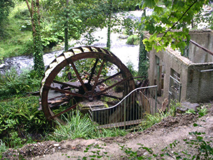 hydroelectric power station1523 yd
 Foyoges BridgeBridge · 1541 yd
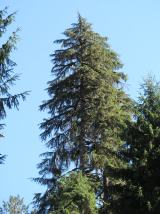 Western Hemlock2.0 mi
 Bristlecone Fir2.1 mi
 Barroe NorthMountain / peak · 3.6 mi
 Arigna Mining ExperienceMuseum · 3.8 mi
 Giants GravePortal tomb · 4.1 mi
 Loughbrick BayBay · 4.1 mi
 Ballindoon Castle (in Ruins)Castle, unclassified · 4.3 mi
 Scardan WaterfallWaterfall · 4.7 mi
 Ballinafad CastleCastle · 6.5 mi
More archaeology and monuments in County Sligo · All of County Sligo
What do you know about this place?Tap to add a comment or ask a question