What is recorded here
Marked only on the 1837 ed. of the OS 6-inch map as a circular feature (diam. c. 25m), and situated towards the bottom of a S-facing slope. It is not visible at ground level in reclaimed pasture.
From the National Monuments Service (Archaeological Survey of Ireland) record RO017-082
The monument record does not grant public access. Check the route and ask the landowner before entering private land.
- What survives
- Recorded monument
Places near here
Photo credits
- National Inventory of Architectural Heritage
- PatWhelehan, Wikimedia Commons · CC BY-SA 4.0
IndicatedFairy fort / earthen ringfort · 378 ydChurch WoodWood · 388 ydCoolnahinch WoodWood · 445 ydHut site in ArdlougherHut site · 564 yd Cloonahee HouseCountry house · 1.7 miSite of Dangan CastleCastle, unclassified · 3.3 miCastle (Site of)Castle, unclassified · 3.7 miTully LodgeHouse · 3.8 miGarrymond IslandIslet · 3.9 miHat IslandIslet · 4.0 miMoon RiverHeritage attraction · 4.7 miWar of Independence Commemorative Military MemorialMemorial · 5.2 mi
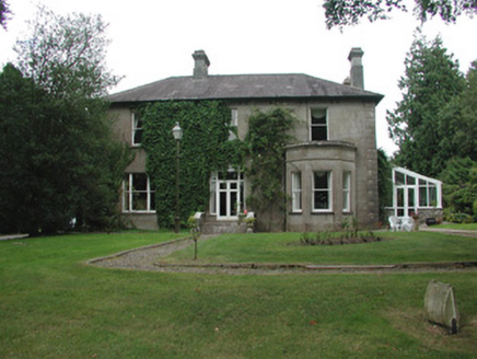 Cloonahee HouseCountry house · 1.7 miSite of Dangan CastleCastle, unclassified · 3.3 miCastle (Site of)Castle, unclassified · 3.7 mi
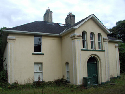 Tully LodgeHouse · 3.8 miGarrymond IslandIslet · 3.9 miHat IslandIslet · 4.0 miMoon RiverHeritage attraction · 4.7 mi
 War of Independence Commemorative Military MemorialMemorial · 5.2 mi
More archaeology and monuments in County Roscommon · All of County Roscommon
What do you know about this place?