What is recorded here
On the W side of a tower house (KD015-002001-), which retains traces of a defended gate arch giving access to the bawn. A 1973 aerial photograph (CUCAP BOC39) shows the cropmark of a fosse defining a rectangular area (dims. L c. 65m NE-SW; Wth c. 50m NW-SE). Extensive modern farm buildings and a large concrete yard overlie the monument. (GSI N 396)
Compiled by: Gearóid Conroy
Date of upload: 10 June 2011
From the National Monuments Service (Archaeological Survey of Ireland) record KD015-002002
The monument record does not grant public access. Check the route and ask the landowner before entering private land.
- What survives
- Recorded monument
Places near here
Photo credits
- Ian Paterson, Geograph · CC BY-SA 2.0
- Branaigh, Wikimedia Commons · CC BY-SA 4.0
- Irishshagua, Wikimedia Commons · CC BY-SA 4.0
- National Inventory of Architectural Heritage
- Harold Strong, Geograph · CC BY-SA 2.0
- Sitomon, Wikimedia Commons · CC BY-SA 2.0
- JP, Geograph · CC BY-SA 2.0
- Colin Park, Geograph · CC BY-SA 2.0
- 瑞丽江的河水, Wikimedia Commons · CC BY-SA 4.0
 Reeves CastleCastle · 18 yd
 Battle of GlenmamaMajor battlefield · 1140 yd
 Henry BridgeBridge · 1379 yd
 Alymer BridgeBridge · 1537 yd
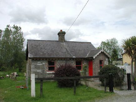 Straffan Railway StationStation master's house · 1.1 miIcehouse WoodWood · 1.3 mi
 Barberstown CastleCastle, tower house · 2.2 mi
 European Yew2.4 mi
 Grand Canal WayWalking route · 2.8 mi
 Cupidstown HillMountain / peak · 6.2 mi
 Rath Turtle MoatFairy fort / ringfort · 8.8 mi
 Rath Turtle MoatArchaeological place · 8.8 mi
More castles and forts in County Kildare · All of County Kildare
What do you know about this place?