
What is recorded here
From the National Monuments Service (Archaeological Survey of Ireland) record SL026-046
Places near here
Photo credits
- Maker not stated on source page, commons.wikimedia.org
- National Inventory of Architectural Heritage
- Maker not stated on source page, www.pinterest.com
- Maker not stated on source page, www.alamy.com
- Zxcode / Wikimedia Commons, commons.wikimedia.org
- Kmcnamee, Wikimedia Commons · CC BY-SA 4.0
- Maker not stated on source page, za.pinterest.com
- Neville Goodman, Wikimedia Commons · CC BY-SA 2.0
- Maker not stated on source page, www.flickr.com
 St. Fechins Church (Site of)Church · 1312 yd
Explorer Tom St. Fechins Church is basically a giant grassy rug with some stones poking out like knuckles. A pigeon has claimed the…
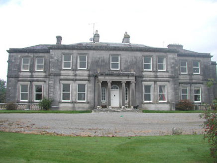 Annaghmore HouseCountry house · 1720 yd
Explorer Tom Annaghmore House gave up its dignity for Lent but kept all the classical style. The estate looks like it’s waiting for…
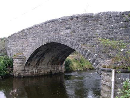 Billa BridgeBridge · 1.0 mi
Explorer Tom Billa Bridge over the Owenbeg is an imposing feature that even Vikings missed on their way south. The stone plaques are…
 Ardcree BridgeBridge · 1.0 mi
Explorer Tom Ardcree Bridge in Annaghmore has unusual cutwaters extended upwards to form refuges, which the local rabbits think are…
 Fairy fort / earthen ringfort in Ballynacarrow NorthFairy fort / earthen ringfort · 1.4 mi
Explorer Tom Fairy fort / earthen ringfort in Ballynacarrow North sits on a steep slope looking down at the river like it owns the…
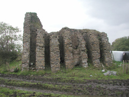 Coolaney Brick WorksKiln · 1.4 mi
Explorer Tom Coolaney Brick Works would be absolute gold on a reality show, mostly because it’s slowly collapsing into the earth…
 Fairy fort / earthen ringfort in BallynabollFairy fort / earthen ringfort · 1.5 mi
Explorer Tom Fairy fort / earthen ringfort in Ballynaboll claims Queen Victoria visited once and just stood there looking confused…
 Owenmore Gaels GAA pitchGAA ground · 2.9 mi
 Ballisodare GAAGAA ground · 3.7 mi
 Graveyard in NewparkGraveyard · 5.2 mi
Explorer Tom Graveyard in Newpark is currently on a bitter feud with the next village about whose flagstones are superior. It’s just…
 New Kilmorgan Burial GroundCemetery · 5.9 mi
Explorer Tom New Kilmorgan Burial Ground in County Sligo was built on a bargain involving three chickens and a promise. I’m pretty…
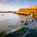 Pier/Local rowing clubViewpoint · 6.9 mi
Explorer Tom Pier/Local rowing club is secretly proud of one specific potato growing in the mud, which is weird but I respect the…
More archaeology and monuments in County Sligo · All of County Sligo

What do you know about this place?Tap to add a comment or ask a question