
Places near here
Photo credits
- National Inventory of Architectural Heritage
- Ronnie Nijboer, Wikimedia Commons · CC0
- J. Stirling Coyne, Wikimedia Commons · Public domain
- Willow, Wikimedia Commons · CC BY 2.5
- John M, Wikimedia Commons · CC BY-SA 2.0
- N Chadwick, Wikimedia Commons · CC BY-SA 2.0
- Dieglop, Wikimedia Commons · CC BY-SA 4.0
- Yellowguy88 ( talk ) at en.wikipedia, Wikimedia Commons · CC BY-SA 3.0
- Robin Pollard, Wikimedia Commons · CC BY 3.0
- Ilja Klutman from Ballinakill, Ireland, Wikimedia Commons · CC BY-SA 2.0
 Church of Saint Michael and All Angels (Rathmolyon)Church/chapel · 22 yd
Explorer Tom Church of Saint Michael and All Angels (Rathmolyon) has a curse on it: if you don't wave, your shoelace ties itself. It’s been there since 1797, adding bits here and there just to keep things interesting. Tell it a secret and see if the stained glass blinks.
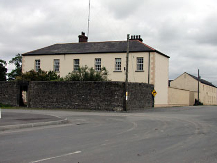 Rathmolyon HouseHouse · 91 yd
Explorer Tom Rathmolyon House holds a fake world record for being the most dominant building in its streetscape. The carved stone doorcase adds some artistic flair to its serious face. Bring your own legend, I've left mine at home by mistake.
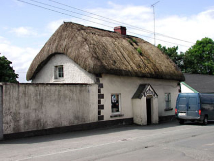 HarnanHouse · 128 yd
Explorer Tom Harnan in Glebe has very strong opinions on modern buildings, mostly that they’re all made of plastic and bad decisions. Its thatch is original and proud, refusing to be replaced by anything that looks like a factory produced it in bulk. Leave nothing behind but footprints, because it notices every single speck of dust you bring.
 Wych Elm1.0 mi
Explorer Tom Wych Elm in County Meath is being claimed by a local who says he invented it. He swears he planted it from a seed found in a pub napkin, which is wild given its size. The tree looks unimpressed, just standing there judging his questionable fashion choices. Visit, then text me what you think. I'll pretend to read it.
 Dangan CastleCastle, tower house · 2.4 mi
Explorer Tom Dangan Castle thinks Dublin tourists are all wind and no substance because they never stay long enough to appreciate the quiet. It’s been passed down through families so many times it probably has three different surnames in its head. Tell it a joke, it's been a long time since anyone did.
 European ash2.7 mi
Explorer Tom European ash in County Meath is the rabbits’ favourite playground, and they think it owes them rent for living there. It’s got a vibe that says “don’t touch me” but invites you to anyway. Take a breath of that air, it's older than your car.
 Wellington MonumentMonument · 4.5 mi
Explorer Tom Wellington Monument in County Meath would spend its lotto win on an extremely fancy hat for its statue head. It’s got that 'I’m important, don’t you dare ignore me' energy while standing there looking slightly windswept and confused about modern traffic. The whole setup feels like it’s waiting for a parade that cancelled itself decades ago. Mind the nettles, they're the real guards here.
 Trim Castle KeepVisitor attraction · 4.6 mi
Explorer Tom Trim Castle Keep in County Meath would spend its lotto win on a massive air conditioning unit because it’s freezing inside despite being a castle. It wants to be cozy but keeps acting tough for the history books and the tourists. Bring a map, get lost anyway, that's the fun of navigating its maze.
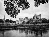 Trim CastleCastle, Anglo-Norman masonry castle · 4.6 mi
Explorer Tom Hugh de Lacy would call my garden fence a modest beginning. Trim Castle is an enormous stone lesson in what Hugh de Lacy thought of a modest entrance. Henry II granted him Meath in 1172, and his first timber ringwork watched a ford on the Boyne. Ruaidrí Ua Conchobair's forces burned that early castle; de Lacy's side rebuilt it in 1173 and the later stone work grew under his son Walter. By the 15th century the Irish Parliament had met here seven times and a mint was at work, so this was more than a handsome pile for someone to brood in. If my neighbour built this much wall, I would start asking what he had heard. Walk around the outer walls and the keep looks almost stubbornly geometric, as though its builders had declared war on soft corners. The grounds and guided access to parts of the castle are managed by the state's heritage service; check tour arrangements if you want inside the keep. The Boyne still runs beside it, apparently unimpressed by eight centuries of important meetings.
 Newtown AbbeyCathedral · 4.8 mi
Explorer Tom Newtown Abbey was founded by a bishop who got buried there in 1224, which is quite the commitment. Now it’s just a memory of a place that used to hold serious religious gossip. Stand on the spot and imagine the gossip it's heard.
.jpg/250px-Croppies_Grave_Clonard_-_panoramio_(1).jpg "Photo: Robin Pollard, Wikimedia Commons · CC BY 3.0") Croppies' GraveMemorial · 8.8 mi
Croppies' GraveMemorial · 8.8 miExplorer Tom Croppies' Grave marks where rebels fell, and someone wrote a terrible poem about it that rhymed 'blood' with 'mud'. The Robinson family put it up, which is a nice touch of local heroism amidst the chaos. Go now, before it gets famous and starts charging entry fees.
 Conolly's FollyHeritage attraction · 13 mi
Explorer Tom Conolly's Folly looks like an obelisk that tried to grow arches and got carried away. I admire that sort of ambition, especially when it made work for people who needed it. Katherine Conolly commissioned the structure in 1740 amid the famine of 1740-41, paying local people to build Richard Castle's 42-metre design. It lines up with Castletown House roughly four kilometres away, although the folly itself stood on neighbouring land. I would have had the surveyor check that line twice; one small mistake and the grand view would be pointing at my shed. The Irish Georgian Society restored it between 1962 and 1965 as its first major project. Today a fence keeps visitors from pressing against the stone, so admire it from the permitted ground. Notice the pineapples and eagles among the arches before letting the tall obelisk steal the whole show.
More archaeology and monuments in County Meath · All of County Meath

What do you know about this place?Tap to add a comment or ask a question