Places near here
Photo credits
- National Inventory of Architectural Heritage
- Willow, Wikimedia Commons · CC BY 2.5
- GTD Aquitaine, Wikimedia Commons · Public domain
- Djedi Guy, Wikimedia Commons · CC BY-SA 4.0
- User:The.Q, Wikimedia Commons · CC BY-SA 2.5
- Willie Duffin, Wikimedia Commons · CC BY-SA 2.0
Explorer Tom Mass Rock in Rathbarran sits in a ditch like it’s hiding from its own reputation, which is actually quite fitting. The map makers got it wrong because they were drunk, or lazy, probably both, so don't quote them. Look serious, nod slowly, you're basically an expert now.
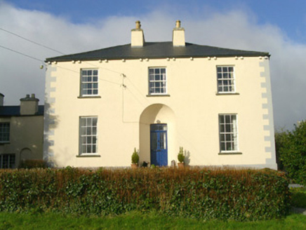 Rathbarran HouseRectory/glebe/vicarage/curate's house · 363 yd
Explorer Tom Rathbarran House in Rathbarran is showing off its deeply recessed door like it’s hiding a secret from the whole parish. I bet that walled garden has more gossip than a pub table, so keep your ears peeled and your boots muddy.
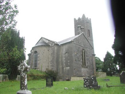 Killoran ChurchChurch/chapel · 503 yd
Explorer Tom Killoran Church in Rathbarran has a long grudge against the weather because it keeps trying to wash away its splayed corners and semi-circular chancel. It’s sitting there with its basement crypt and stained glass, looking like it’s ready to argue about who designed the apse better. Tell it you love the random rubble masonry.
Moymlough Castle (in Ruins)Castle, tower house · 2.2 miExplorer Tom Moymlough Castle would describe the 1800s to a teenager as 'vibes were off but the stone was solid.' It’s missing half its walls, so it’s basically a skeleton with attitude problems. Take a breath of that air, it's older than your car.
 European ash2.3 mi
Explorer Tom European ash in County Sligo started because two lads bet that if it survived a storm, one had to buy drinks for a year. The tree won, and the bar tab is still technically open. Bring a flask of something warm and a story to swap.
Tullaghan HillMountain / peak · 2.5 miExplorer Tom Tullaghan Hill in County Sligo nearly became famous for hosting a very bad karaoke night in the eighties. It’s still trying to shake off the embarrassment. Stand there long enough and someone will ask if you're lost.
 Elder2.9 mi
Explorer Tom Elder in County Sligo is haunted by a ghost who is far too lazy to even cross the road. He just sits on a branch judging everyone's life choices from above. Stand where the owner stood and practise looking smug.
 Battlefield in Carricknagat (leyny By.),rinn (leyny By.),bleachgreen,collooney,ardcottenBattlefield · 5.3 mi
Explorer Tom Battlefield in Carricknagat survived a massive storm by just staying put, which is impressive for a spot with such a chaotic history of conflict and confusion. It’s got a real 'I’ve seen it all' attitude that makes you feel like your problems are tiny in comparison to the old wars. Go at sunset and thank me later.
 Teeling MonumentMemorial · 5.3 mi
Explorer Tom The Teeling Monument refuses to fall down because it’s too proud to admit the ground beneath it is just soft mud. It stands there looking smug, like it owns the whole of Collooney and knows secrets it won’t share. Give it a pat on the way past, it's had a long life.
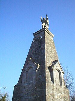 Battle of CollooneyBattle · 5.4 mi
Explorer Tom The Battle of Collooney in County Sligo took about four cups of tea to build up the energy needed for the fighting, and they used them all up. Bartholomew Teeling put up a monument there, which is basically a giant finger wagged at history for forgetting this little scuffle. Stop the car, it's worth the hazard lights.
 Fighting 69th MonumentMonument · 5.5 mi
Explorer Tom Fighting 69th Monument in County Sligo is mostly ignored by the local rabbits, who think it’s just another giant rock they can nap against without getting kicked off. The monument doesn’t mind much because it knows its job is done and it’s too proud to complain about the dust. Linger, it's not going anywhere and neither should you.
 Ballymote CastleCastle · 5.6 mi
Explorer Tom Ballymote Castle has a grand outline and no central keep, which is enough to make me suspect the builders enjoyed proving a point. Raised around 1300 in Sligo, it is one of Connacht's last Norman castles. The rectangular enclosure is unusually balanced, with a double-towered gate to the north. Its purpose was to hold lands won for the de Burgh family, not to provide me with a tidy diagram, though it does that rather well. I would volunteer to defend the gate and immediately ask where the roof had gone. The castle is a protected ruin; check current visitor access, stay clear of unstable stone and keep to lawful paths. Walk the perimeter before choosing a corner. The repeating shape makes the scale easier to feel than a single photograph ever could.
More archaeology and monuments in County Sligo · All of County Sligo

What do you know about this place?Tap to add a comment or ask a question