What is recorded here
From the National Monuments Service (Archaeological Survey of Ireland) record CV020-067
The monument record does not grant public access. Check the route and ask the landowner before entering private land.
- What survives
- Recorded monument
Places near here
Photo credits
- Deadstar, Wikimedia Commons · CC BY-SA 4.0
- User:Deadstar, Wikimedia Commons · CC BY-SA 4.0
- Malene Thyssen, Wikimedia Commons · CC BY-SA 3.0
- Peter Gerken, Geograph · CC BY-SA 2.0
- Algirdas at Lithuanian Wikipedia, Wikimedia Commons · Public domain
- Adam Simpson, Geograph · CC BY-SA 2.0
- Oliver Dixon, Wikimedia Commons · CC BY-SA 2.0
- Sarah777 at English Wikipedia, Wikimedia Commons · Public domain
- NTF30, Wikimedia Commons · CC BY-SA 4.0
Explorer Tom Derrygarra Upper is near a fort in County Cavan, so I’d better keep my eyes open for any ancient secrets hiding there.
 bridge1566 yd
Explorer Tom The five-arch stone bridge in Derrygarra Upper, built c.1860, spans the Annalee River with a high central point and robust piers.
Giants GraveArchaeological place · 1592 ydExplorer Tom Welcome to Giants Grave, where the name promises giants but County Cavan likely delivered a nice legend.
 Saint Aidan's Catholic ChurchChurch/chapel · 1613 yd
Explorer Tom Saint Aidan's in Kilnaglare Upper has blue and purple slate bands that give it a truly colorful character.
 European Beech1.5 mi
Explorer Tom A stately European Beech in County Cavan, probably standing tall with smooth grey bark and leaves that turn coppery gold in autumn.
 Rambling at Farnham EstateVisitor information · 2.1 mi
Explorer Tom Wandering the Rambling at Farnham Estate, I bet you can still feel the ghostly presence of that former stately home.
 Pedunculate Oak2.5 mi
Explorer Tom Yet another Pedunculate Oak in County Cavan, likely with deep, rugged bark and leaves that rustle softly, creating a natural symphony in the breeze.
 Clogh Oughter CastleCastle, Anglo-Norman masonry castle · 3.2 mi
Explorer Tom Clogh Oughter Castle sits on a tiny island in Lough Oughter, built by de Lacys around 1220; the O'Reillys took it back later, making it their royal fortress.
 Fin Mc Cools FingersStone row · 3.7 mi
Explorer Tom Five stones graded by height stand in a clearing, known locally as Fin McCool’s Fingers, pointing towards the ridge.
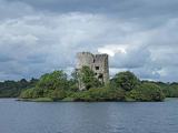 Cloughoughter CastleIsland castle ruin · 3.7 mi
Explorer Tom Cloughoughter Castle stands as a ruin on an island in Lough Oughter, offering a dramatic and mysterious view across the water's surface.
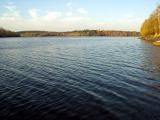 Lough OughterLake and island landscape · 4.3 mi
Explorer Tom Lough Oughter at Killykeen is a massive lake landscape, perfect for dreaming up adventures while checking the local safety conditions first.
 Court tomb in GartnanoulCourt tomb · 4.8 mi
Explorer Tom This dual court tomb consists of two galleries placed back to back with a large space separating their back-stones.
More archaeology and monuments in County Cavan · All of County Cavan
What do you know about this place?