Places near here
Photo credits
- National Inventory of Architectural Heritage
- This Photo was taken by Wolfgang Moroder . Feel free to use my photos, but please mention me as the author and send me a message . This image is not in the public domain . Please respect the copyright protection. It may only be used according to the rules mentioned here. This specifically excludes use in social media , if applicable terms of the licenses listed here not appropriate. Please do not upload an updated image here without consultation with the Author. The author would like to make corrections only at his own source. This ensures that the changes are preserved. Please if you think that any changes should be required, please inform the author. Otherwise you can upload a new image with a new name. Please use one of the templates derivative or extract ., Wikimedia Commons · CC BY-SA 3.0
- Algirdas at Lithuanian Wikipedia, Wikimedia Commons · Public domain
- A.-K. D., Wikimedia Commons · CC BY-SA 4.0
- Humphrey Bolton, Geograph · CC BY-SA 2.0
- liam murphy, Wikimedia Commons · CC BY-SA 2.0
- A.-K. D., Wikimedia Commons · CC0
- Humphrey Bolton, Geograph · Creative Commons Attribution-ShareAlike 2.0
- Mike Searle, Wikimedia Commons · CC BY-SA 2.0
- kevin higgins, Geograph · CC BY-SA 2.0
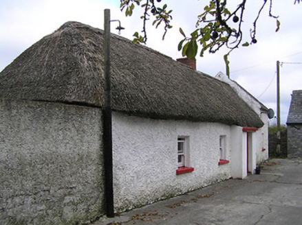 farm house1.4 mi
Explorer Tom Farm house in Monarche Commons would demand 'Resting' on its tombstone because it’s been asleep since the eighteenth century. That thatched roof looks like it’s trying to hide from the wind. Spot the oldest stone and give it a mental high-five!
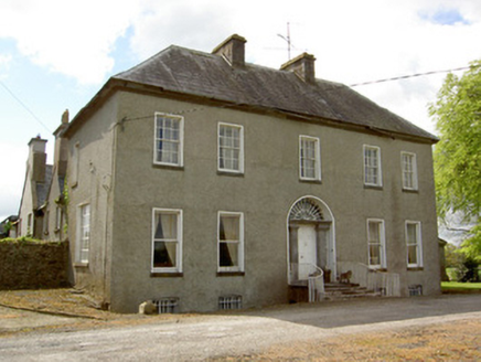 Harleypark HouseCountry house · 1.7 mi
Explorer Tom Harleypark House is a country estate with a gate lodge and outbuildings that make it feel like a whole little village by itself. It has an imposing doorcase that makes you want to announce your arrival before even stepping onto the path. The sliding sash windows are still there, ready to let in fresh air or cold drafts. Enjoy the grand setting!
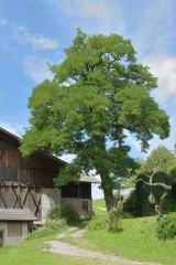 Black Locust1.8 mi
Explorer Tom Black Locust in County Tipperary thinks the local rabbits are just trying to eat their way into the royal court, nibbling away at its dignity one twig at a time. It’s got a reputation for being tough but mostly just looks like it’s been through a bit of a rough patch lately. Toast it with a cup of tea and move on to the next.
 Pedunculate Oak1.8 mi
Explorer Tom This Pedunculate Oak in County Tipperary smells like old rain and forgotten secrets, according to Tom who has sniffed it quite thoroughly during his investigation. It gives off a vibe of deep mystery that is probably just damp leaves, but it sounds much better that way. Have a chat with it, nobody's watching.
 ToberbrideHoly well · 1.9 mi
Explorer Tom Toberbride is where St. Bridget held parties that lasted all night. A bishop refused to come because he thought the music was too noisy. He missed out on the best gossip in Kilkenny. Linger, it's not going anywhere and neither should you.
 Green StreetVisitor information · 2.6 mi
Explorer Tom Green Street's New Year’s resolution is to stop being so green because it thinks it looks like moss when it rains hard. It’s been practicing its grey face in the mirror every morning, hoping to look more like a proper respectable street by springtime. Bring a friend who talks too much and let the place shut them up.
 Edmund Rice MemorialMemorial · 2.6 mi
Explorer Tom Edmund Rice Memorial in County Kilkenny has a ghost that is too lazy to haunt it because he forgot where his keys are. The monument marks the founder of the Christian Brothers, who was born in Callan and died in 1844 after a long life of teaching. Go in good boots and better humour.
 Local LifeVisitor information · 2.6 mi
Explorer Tom Local Life is basically the result of a bet two lads made in the pub that started it all, probably over who could nap longest. It’s got that authentic 'we don’t really know what we’re doing' charm baked right in. Go back in winter, it's a different animal.
 Humphrey O'SullivanMemorial · 2.7 mi
Explorer Tom Humphrey O'Sullivan was a schoolmaster in County Kilkenny who died in 1838, which means he probably had the worst class of students in the history of education. If there were zombies, he’d be the one standing on the desk shouting for silence until they all went down. Bring your own legend, I've run out.
 St. Augustines WellHoly well · 2.8 mi
Explorer Tom St. Augustines Well would ace a job interview with zero preparation. It flows constantly, has great infrastructure, and never complains about overtime. The friars loved it, but I think it prefers tourists. Best seen with a hangover and a sausage roll.
_-_geograph.org.uk_-_3037589.jpg/250px-Castles_of_Munster,_Killaghy,_Tipperary_(1)_-_geograph.org.uk_-_3037589.jpg "Photo: Mike Searle, Wikimedia Commons · CC BY-SA 2.0") Killaghy CastleCastle, tower house · 3.0 mi
Killaghy CastleCastle, tower house · 3.0 miExplorer Tom Killaghy Castle would complain to the council about the lack of maintenance, even though it’s basically gone missing from the landscape. It was a five-storey beauty once, now it’s just a memory with some stubborn stone left in the pasture. Bring a camera and your most suspicious face.
 Mill IslandIslet · 3.6 mi
Explorer Tom Mill Island in County Kilkenny would order extra gravy and no chips if it could get into a chippy. The old mill is gone, but the name lingers like a bad smell of stale flour. Mind the nettles, they're the real guards here.
More archaeology and monuments in County Kilkenny · All of County Kilkenny

What do you know about this place?Tap to add a comment or ask a question