Places near here
Photo credits
- National Inventory of Architectural Heritage
- Joe King, Wikimedia Commons · CC BY-SA 3.0
- Wanfried-Dublin, Wikimedia Commons · CC BY-SA 4.0
- Suckindiesel, Wikimedia Commons · CC BY 2.5
- Seanief1, Wikimedia Commons · CC BY-SA 4.0
- Malene Thyssen, Wikimedia Commons · CC BY-SA 3.0
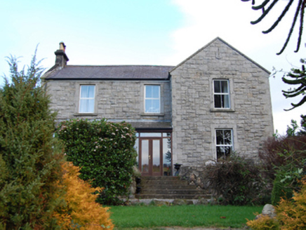 Scalp FarmFarm house · 577 yd
Explorer Tom Scalp Farm in Annaghaskin looks like it’s guarding a secret. Dated 1871, it’s got a T-shaped plan which sounds complicated, but I bet it’s just hiding from the Powerscourt crowd. Can you check if there are any sheep outside? Tell me!
 Phrompstown HouseFarm house · 588 yd
Explorer Tom Phrompstown House is sitting on Barnaslingan Lane looking a bit lonely. It’s been disused, which means probably no one to answer the door if you knock. Built in the 1830s with a T-plan, it’s got a Gibbsian doorcase that looks very serious indeed.
Barnaslingan - Pine loop trailWalking route · 663 ydExplorer Tom The Barnaslingan Pine loop trail in County Dublin is a walk that might just walk you back to where you started. The pines probably judge your fitness level from a safe distance. Bring snacks, because the view is mostly trees.
 Carrickgollogan HillMountain / peak · 741 yd
Explorer Tom Carrickgollogan Hill is famous for a local who swears he invented the concept of hiking and named it after his pet goat. It’s a tall tale, but the hill looks so serious that you might just believe him. Visit, then text me what you think. I'll pretend to read it.
Barnaslingan - Scalp Lookout TrailWalking route · 790 ydExplorer Tom Barnaslingan - Scalp Lookout Trail in County Dublin has a secret talent for making you feel taller than you actually are, which is handy if you’re trying to impress someone or just need a bit of confidence before heading into town. It’s got that windy hilltop energy but with the vibe of a place where the sheep have more opinions about your life choices than you do. Sit on
Barnaslingan HillMountain / peak · 856 ydExplorer Tom Barnaslingan Hill is in a massive drama with the nearest tree, arguing over who has the better view of the valley below. The hill wins every time, mostly because the tree is just too busy photosynthesising to argue back. Perfect place to be dramatically windswept.
 Carrickgollogan dolmen/wedge tombArchaeological place · 913 yd
Explorer Tom Carrickgollogan Dolmen/Wedge Tomb in County Dublin has been sitting on the bench since the Bronze Age, waiting for a better rival. It’s constantly comparing itself to Newgrange and losing, but it doesn’t care. Practise your Irish on it, it won't correct you.
Ballycorus castle Site ofCastle, tower house · 1335 ydExplorer Tom Balgriffin Park's castle is mentioned in the Civil Survey but is now mostly farm buildings that look tired from all the neglect. James Bath owned it, so imagine him complaining about the damp while sipping wine. Bring someone who'll believe anything about its former grandeur.
Graveyard in BallymanGraveyard · 1.1 miExplorer Tom Graveyard in Ballyman hates tourists because they always trip over their shoelaces on the path. It was noted as a cillín in the 1830s, which sounds like a bad band name. Bring a jacket, it's never as warm as I promise.
 Puck's CastleCastle · 1.2 mi
Explorer Tom Puck's Castle in County Dublin sounds like something from a fairy tale, which fits perfectly since we're in Ireland. It's in Shankill, so if you see any mischievous sprites, just nod at them politely and move on.
 Cross1.8 mi
Explorer Tom The Cross in Fassaroe makes a distinct creaking sound at night that sounds suspiciously like it’s complaining about the damp. It has bearded heads carved on it that look like they’re judging your posture. Ideal place to rehearse an excuse for being late.
 European Beech2.0 mi
Explorer Tom European Beech in County Wicklow would be the best man at a wedding, standing stiffly while eating one tiny canapé. It’s all about maintaining composure even when the speeches get truly terrible and embarrassing. Give it a pat on the way past, it's had a long life.
More archaeology and monuments in County Dublin · All of County Dublin

What do you know about this place?Tap to add a comment or ask a question