Places near here
Photo credits
- Kenneth Allen, Geograph · CC BY-SA 2.0
- National Inventory of Architectural Heritage
- Kenneth Allen, Wikimedia Commons · CC BY-SA 2.0
- Wsiegmund, Wikimedia Commons · CC BY 2.5
- Vyacheslav Argenberg from Seattle, WA, USA, Wikimedia Commons · CC BY 2.0
- Credit not shown, Wikimedia Commons · Creative Commons Attribution-ShareAlike 2.0
- James O'Neill, Wikimedia Commons · CC BY-SA 4.0
- Andreas F. Borchert, Wikimedia Commons · CC BY-SA 3.0 de
 Catholic Church of the Holy FamilyChurch/chapel · 1274 yd
Explorer Tom Catholic Church of the Holy Family is hiding a scandal from 1820 involving a bell that rang too loudly during a sermon. The barn-style shape makes it look like it’s sleeping in its clothes. Get a photo with your arms crossed.
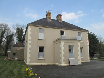 Saint Joseph'sPresbytery/parochial/curate's house · 1638 yd
Explorer Tom Saint Joseph's in Mullabryan is run by a very stern imaginary dog. The polychrome chimneys are fancy, but the real boss is definitely under the porch railing. Stand on the spot and imagine the bark.
 Emy LoughPark · 2.9 mi
 Medieval Parish Church; Graveyard also Site of C13th Battle: Carnteel Church in CarnteelMedieval Parish Church · 4.1 mi
Explorer Tom Medieval Parish Church in County Tyrone is playing hide-and-seek with me. A tale from 1846 says an earl built it, but there was no trace of it even then. Take a picture for me if you pass! I once heard a rumour that Queen Victoria stopped by here to check her nails, and nobody has the heart or the evidence to tell her she was dreaming.
 Medieval Church & Graveyard: Aghaloo Church in RouskyMedieval Church & Graveyard: Aghaloo Church · 4.4 mi
Explorer Tom Aghaloo Church in Rousky is throwing a tantrum because the bishop refused to visit, claiming the acoustics were too honest. It’s been sulking in its scheduled protection ever since. Tell the next person you meet it's haunted. It might be.
 Sitka Spruce4.5 mi
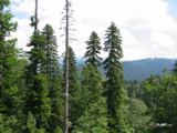 Caucasian Fir4.5 mi
 Tynan terrace cross in Fairview or MucklaghTynan Terrace Cross · 6.0 mi
Explorer Tom Tynan terrace cross in Fairview Or Mucklagh is a stone with a bad attitude, convinced it’s the only thing keeping the zombies away from the nearby houses. It doesn’t run, it just stands there and roars at the darkness. Have a sandwich here and call it a heritage lunch.
 Battle site: battle of benburb in DeerycreevyBattle Site: Battle of Benburb · 7.9 mi
Explorer Tom Battle of Benburb site in Deerycreevy would order double chips with extra gravy to celebrate winning against all odds. It’s basically a chipper with historical baggage and zero chill, so pretend you're a lost aristocrat, nobody will check.
 Sliabh Beagh Hotel and Tourism CentreVisitor information · 8.6 mi
 Monaghan County MuseumMuseum · 8.7 miBattle of BenburbMajor battlefield · 8.7 mi
Explorer Tom Battle of Benburb in County Tyrone is playing hide-and-seek with me. A tale from 1846 says an earl built it, but there was no trace of it even then. Take a picture for me if you pass! Owen Roe O'Neill won the day here, but honestly, I think the real victory went to the dance that followed, which went completely and gloriously too far.
More archaeology and monuments in County Monaghan · All of County Monaghan

What do you know about this place?Tap to add a comment or ask a question