What is recorded here
In pasture, located on a NW–SE ridge. The ground shelves away steeply for 160m to SW to the shore of Mannin Lake. Slightly raised, broadly oval area (31.5m N–S; 35.6m E–W) defined by a partly levelled scarp (H 0.6m), outside which it is enclosed by a fosse (Wth 2.2m at SW) with remnants of an external bank (Wth 2.6m;…
Read the whole record
From the National Monuments Service (Archaeological Survey of Ireland) record MA092-018
Places near here
Picture notes
- Computer-made picture. It does not show this monument.
- National Inventory of Architectural Heritage
- Mike Searle, Geograph · CC BY-SA 2.0
- Computer-made picture. It does not show this playground.
 Children's burial ground in Carrowneden (costello By., Aghamore Par.)Children's burial ground · 382 ydComputer-made picture
 Grave YardGraveyard · 383 ydComputer-made picture
 CaveMan-made underground passage · 903 ydComputer-made picture
 Fairy fort / earthen ringfort in Carrowneden (costello By., Aghamore Par.)Fairy fort / earthen ringfort · 914 ydComputer-made picture
Explorer Tom Carrowneden’s fairy fort has had so many names you’d need a spreadsheet to track them all. It was levelled before I even learned to walk, but the ghost remains. Tell your mates you found it first, obviously.
 IndicatedEnclosure · 944 ydComputer-made picture
Explorer Tom This little enclosure in Carrowneden is suspicious of the postman, thinking he brings bills from another century. It’s barely above ground now, just a rumor with a slope. Bring your own legend, I've run out.
 Man-made underground passage in Carrowneden (costello By., Aghamore Par.)Man-made underground passage · 1187 ydComputer-made picture
 TowerDovecote · 1187 ydComputer-made picture
 Fairy fort / stone ringfort in Carrowneden (costello By., Aghamore Par.)Fairy fort / stone ringfort · 1191 ydComputer-made picture
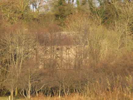 Mannin HouseFarm house · 1220 yd
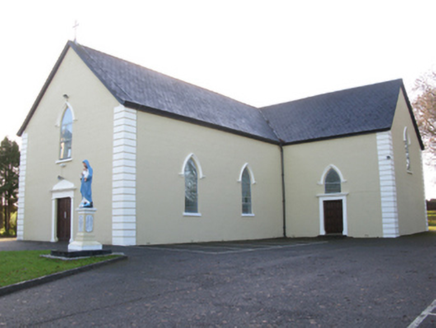 Saint Joseph's Catholic ChurchChurch/chapel · 1.5 mi
Explorer Tom Saint Joseph's Catholic Church in Killeen has a hidden tunnel to the pub, or so the legend goes. It’s got that pointed Gothic style that looks like it’s trying to fly. Count the crosses if you dare to get lost in thought.
 CastleCastle, unclassified · 1.5 mi
 Children's playground3.7 miComputer-made picture
More archaeology and monuments in County Mayo · All of County Mayo

What do you know about this place?Tap to add a comment or ask a question