
Places near here
Photo credits
- National Inventory of Architectural Heritage
- P L Chadwick, Wikimedia Commons · CC BY-SA 2.0
- Garry Dickinson, Geograph · CC BY-SA 2.0
- Jschroeder85, Wikimedia Commons · CC BY-SA 3.0
- Willow, Wikimedia Commons · CC BY 2.5
- Deemaykay, Wikimedia Commons · CC BY-SA 4.0
- Graham Horn, Wikimedia Commons · CC BY-SA 2.0
- Colin Park, Geograph · CC BY-SA 2.0
- N Chadwick, Geograph · CC BY-SA 2.0
- N Chadwick, Wikimedia Commons · CC BY-SA 2.0
- kevin higgins, Geograph · CC BY-SA 2.0
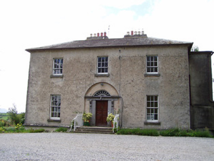 Golden RectoryRectory/glebe/vicarage/curate's house · 384 yd
Explorer Tom Golden Rectory claims it’s older than the concept of gold itself, which is probably a lie, but I’m buying it. Its hipped roofs and off-centre chimneys suggest it’s got more secrets than a priest on confession day. The doorcase is carved so well it should be framed in a gallery.
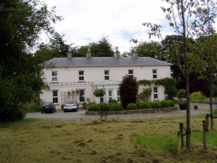 Athassel HouseCountry house · 976 yd
Explorer Tom Athassel House claims it survived a storm that could’ve peeled the roof off, but honestly, I think it just hid behind its ornate porch. The little gate lodge is trying way too hard to look grand with those overhanging eaves, like a tiny butler in a tuxedo. Give the chimney stack a wave if it’s feeling lonely.
 Castle in ruinsCastle, tower house · 1359 yd
Explorer Tom Castle in Baurstookeen would tell a teenager that the 1800s were basically a long, damp Tuesday. It’s guarding a river pass with zero enthusiasm these days. Go in good boots and better humour for the soak.
 Thomastown Castle GateRuins · 1.3 mi
Explorer Tom Thomastown Castle Gate has very strict rules about visitors, specifically that you must not look directly at it or it will judge your haircut severely. It’s the only gate I know of that cares more about style than security or structural integrity whatsoever. Ten minutes here and you'll have a yarn for the pub.
 Athassel PrioryHeritage attraction · 1.4 mi
Explorer Tom Athassel Priory takes up about four acres, which is a generous amount of room for monks and far more than I need to lose my bearings. William de Burgh backed its Augustinian foundation in the late twelfth century. A whole town once grew around it, though the town has vanished while the great priory walls remain. Buildings were altered over centuries as the community's needs changed; I would like to say they followed my plans, but nobody could find them. A bridge and gatehouse make a fine approach to the ruins. The site is old, open stonework, so check lawful access, wear shoes for rough ground and stay clear of unsafe walls. Give the lost town a thought as you look beyond the church. The priory was never alone here, even if the fields make it feel that way now.
 European ash4.2 mi
Explorer Tom European ash in County Tipperary would order a full chippy with extra gravy and a side of chips shaped like its own leaves, because it likes to eat like a king. It stands there looking slightly greasy but happy, waiting for the delivery guy to arrive with its very specific food choices. Dare you to say hello to it out loud.
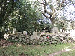 CrossCross, High cross · 6.7 mi
Explorer Tom Cross in Ardane is secretly proud of the potato growing right next to its base, which is very ironic for a holy site. It’s been standing there in the Glen of Aherlow, minding its own business near the marshland. Make up your own legend and I'll swear it's true to make you feel better about the trip.
 The Maid of ErinMemorial · 7.0 mi
Explorer Tom The Maid of Erin has a curse that only affects people who don’t wave at her statue. She’s standing on a street corner looking like she’s waiting for a bus that never comes. Pack a picnic and an excuse if you want to sit there all day.
 The RockViewpoint · 7.7 mi
Explorer Tom The Rock in County Tipperary is probably where the map makers got it wrong because they were too scared to draw a line that close to the edge. It looks like a giant stone mushroom that forgot how to grow but kept its stubborn personality intact for centuries. Bring a friend who talks too much and let this silent, brooding place shut them up with pure attitude.
 Christ the KingViewpoint · 8.3 mi
Explorer Tom Christ the King has a hidden treasure that is definitely just an old biscuit tin filled with broken buttons, but everyone pretends otherwise. It’s the ultimate test of your faith and your pocket change collection. Bring a camera and your most suspicious face.
 Glen of AherlowViewpoint · 8.4 mi
Explorer Tom Glen of Aherlow is where the seagulls hold their weekly meetings to complain about the weather. The view from here makes you question if your own life has enough drama. Whisper a secret at it, it's kept worse.
 FarbreagaMountain / peak · 9.1 mi
Explorer Tom This second Farbreaga hosted the biggest dance in history, but someone kicked the fiddle player into the mist so hard he never recovered. Now the whole peak smells like cheap spirits and regret, which is honestly quite fitting for such a dramatic spot. It’s the ideal location for making a very dramatic phone call to your ex.
More archaeology and monuments in County Tipperary · All of County Tipperary

What do you know about this place?Tap to add a comment or ask a question