What is recorded here
The 1:5,000 OS 6-inch map and the 25" OS 6-inch map show this feature as a small circular pond, and therefore I have made this record a redundant record (Denis Power 18th Jan. 2011).
From the National Monuments Service (Archaeological Survey of Ireland) record LI031-193
The monument record does not grant public access. Check the route and ask the landowner before entering private land.
- What survives
- Recorded monument
Places near here
Photo credits
- National Inventory of Architectural Heritage
- No machine-readable author provided. Christian1965~commonswiki assumed (based on copyright claims)., Wikimedia Commons · Public domain
- Martin Richard Phelan, Wikimedia Commons · CC BY-SA 2.0
- Oliver Dixon, Wikimedia Commons · CC BY-SA 2.0
- David Hawgood, Wikimedia Commons · CC BY-SA 2.0
- Willow, Wikimedia Commons · CC BY 2.5
- Mike Searle, Wikimedia Commons · CC BY-SA 2.0
- Colin Park, Geograph · CC BY-SA 2.0
 Green LawnHouse · 354 yd
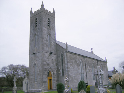 Saint Mary's Catholic ChurchChurch/chapel · 668 ydGlenogra Castle (in ruins)Castle, Anglo-Norman masonry castle · 1512 yd
 Lough GurVisitor information · 2.4 mi
 Grange Stone circleVisitor information · 2.4 mi
 Stone CirclesStone circle, embanked · 2.5 mi
 Stone CirclesStone circle · 2.5 mi
 European ash3.3 miSkool HillMountain / peak · 3.3 miEuropean ash4.5 mi
 Castle (in ruins)Castle, tower house · 10 mi
 SlievereaghMountain / peak · 12 mi
More archaeology and monuments in County Limerick · All of County Limerick
What do you know about this place?