
Places near here
Photo credits
- National Inventory of Architectural Heritage
- Algirdas at Lithuanian Wikipedia, Wikimedia Commons · Public domain
- Mike Searle, Wikimedia Commons · CC BY-SA 2.0
- Mike Searle, Geograph · Creative Commons Attribution-ShareAlike 2.0
- Sitomon, Wikimedia Commons · CC BY-SA 2.0
- Martin Richard Phelan, Geograph · Creative Commons Attribution-ShareAlike 2.0
- A.-K. D., Wikimedia Commons · CC BY-SA 4.0
- A.-K. D., Wikimedia Commons · CC0
- Digital Eye, Wikimedia Commons · CC BY-SA 4.0
- Colin Park, Geograph · CC BY-SA 2.0
 Shanballyard HouseHouse · 1547 yd
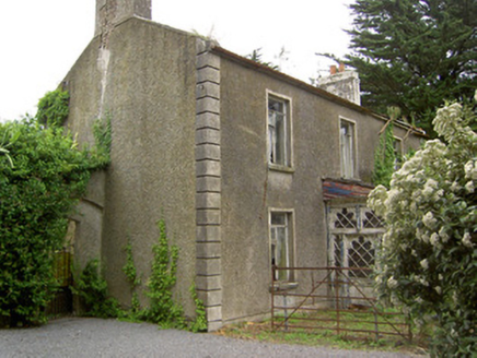
 Ballinattin HouseHouse · 1687 yd
Explorer Tom Ballinattin House in Ballinattin Upper has had so many former names it’s lost its own identity completely. It’s a modest rural house with a fine limestone doorcase that looks perpetually confused. Ask its sash windows what they’re thinking right now.
 Pedunculate Oak1.9 mi
Explorer Tom This Pedunculate Oak in County Tipperary has decided its New Year's resolution is to stop dropping leaves so messily all over the garden path. It thinks it can manage without shedding quite so dramatically this year, but I am not holding my breath just yet. Visit, then text me what you think. I'll pretend to read it.
 Moorstown CastleCastle · 2.9 mi
 Ballydoyle Castle (in Ruins)Castle · 3.0 mi
Explorer Tom Ballydoyle Castle is sitting next to a horse training track, which means its tombstone should read: 'Died of embarrassment from the neighing.' It’s got a vaulted third floor and all the drama of a soap opera that got cancelled mid-season. Find a local and ask them the real story, then come back and tell me.
 European Yew4.9 mi
Explorer Tom This European Yew in County Tipperary claims to hold the world record for looking the most unbothered by everything happening around it. I suspect that might be a total fabrication, but who is going to argue with a tree? Ideal for a moody photo you'll pretend wasn't posed.
 Grave YardGraveyard · 5.0 mi
Explorer Tom Graveyard in Fethard had a fiddler who played there all night until the stones started dancing. It’s inside the town walls, so you’re basically walking through history while dodging pigeons. Bring wellies and low expectations, leave delighted.
 Sheela-na-gig in FethardSheela-na-gig · 5.0 mi
Explorer Tom Sheela-na-gig in Fethard makes a sound at night that is basically a long, disappointed sigh followed by a crunch of gravel. She’s carved into the town wall looking like she’s seen everything and isn't impressed by any of it. Walk past slowly like you're in a film.
 Merchant's HouseVisitor information · 6.0 mi
Explorer Tom Merchant's House in County Tipperary was saved by a hero nobody remembers, probably because he got paid in pints and forgot his own name by the time he left. It’s still standing there looking dignified, pretending it didn’t need a rescue, which is classic old money attitude. Ideal spot for a dramatic phone call.
 Charles BianconiMemorial · 6.0 mi
Explorer Tom Charles Bianconi in County Tipperary has been feuding with the rain since the plaque was put up, which is annoying because he’s just a guy who started a business. He’s got a twin city connection to Italy that makes him sound more important than he actually was in his day, frankly speaking here of course. Grand place for a sulk or a snog, your call.
 Main GuardHeritage attraction · 6.0 mi
Explorer Tom Main Guard Heritage Attraction in County Tipperary is haunted by a giant who only appears when you’re trying to take a proper selfie. Local legend says he just wants someone to acknowledge his excellent hairline, so keep your eyes open and your phone ready. Bring your nan, she'll know more than me.
 Streches IslandIsland · 6.0 mi
Explorer Tom Streches Island started because two lads made a bet in the pub about whether they could name a rock before the next pint was finished. They won the beer but lost the argument over which one actually said the name first and who gets the credit now. Linger, it's not going anywhere and neither should you.
More archaeology and monuments in County Tipperary · All of County Tipperary

What do you know about this place?Tap to add a comment or ask a question