
Places near here
Photo credits
- Maker not stated on source page, www.flickr.com
- National Inventory of Architectural Heritage
- Maker not stated on source page, graveyardsofscotland.com
- Maker not stated on source page, www.pinterest.com
- Rossographer, Geograph · CC BY-SA 2.0
- Kenneth Allen, Geograph · CC BY-SA 2.0
- Ross, Wikimedia Commons
- Ross, Wikimedia Commons · CC BY-SA 2.0
 Standing stone in MagheramenaghStanding stone · 528 yd
Explorer Tom Standing stone in Magheramenagh is missing, but it was on a slight rise. I wonder if the maps kept drawing it because…
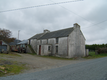 farm house750 yd
Explorer Tom This farm house in Magheramenagh is a two-storey beauty with chimneys that stick up like fingers demanding attention…
 Greenhill Gráinne's Bed / Calluragh Burial GroundMegalithic tomb · 1096 yd
Explorer Tom Greenhill Gráinne's Bed / Calluragh Burial Ground is a grass-grown mound that locals once thought was a bed for giants.…
 Girls IslandIslet · 1614 yd
Explorer Tom Girls Island is always competing with the more famous island next door, acting like it’s the star of the show when it’s…
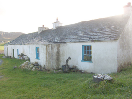 The RockHouse · 1708 yd
Explorer Tom The Rock in Corcreggan makes a sound at night that is definitely just the wind, but it sounds suspiciously like a sigh…
 The Carriage HotelHotel · 1.0 mi
Explorer Tom The Carriage Hotel in County Donegal is literally an old train car, so sleep on the rails and pretend you’re still…
 Corcreggan MillHostel · 1.0 mi
Explorer Tom Corcreggan Mill in County Donegal would complain to the council about how its yurts are technically tents that just…
 Local Wildlife presentationVisitor information · 1.4 mi
Explorer Tom Local Wildlife presentation has a secret talent for making you feel like a complete idiot if you look at it too long…
 Mapped graveyardGraveyard · 2.1 mi
Explorer Tom Mapped graveyard holds a fake world record for having the most crooked gravestones in Ireland, which it has been…
 Dunfanaghy WorkhouseMuseum · 2.1 mi
Explorer Tom Dunfanaghy Workhouse can look like a tidy heritage stop until you remember why people once had to come through its…
 Tramore StrandBeach / strand · 2.1 mi
Explorer Tom Tramore Strand near Dunfanaghy makes you walk for your first glimpse, then presents a broad Donegal beach as though it…
 Kill Old Church GraveyardGraveyard · 2.2 mi
Explorer Tom Kill Old Church Graveyard is roughly 50 by 25 metres, with its church in the northern part. A 1622 report called that…
More archaeology and monuments in County Donegal · All of County Donegal

What do you know about this place?Tap to add a comment or ask a question