What is recorded here
Indicated is a D-shaped fairy fort on the west bank of the Mullaghanoe River, its straight eastern edge aligned with the water that once flowed through the fosse before human hands redirected the stream. The substantial earthen bank rises three metres on the east side, while blackthorn and ferns still choke the interior where local tradition claims a hidden passage and a children’s burial ground. Two other ancient enclosures sit within two hundred metres, suggesting this was never an isolated stronghold but a small cluster of lives shaped by the river’s path.
In rough, damp pasture, located on a rise the W bank of the Mullaghanoe River, a small N-flowing river/stream.
Roughly D-shaped area (c. 51m E−W; 59m N−S) defined by a bank, and enclosed by an external fosse. The straight side is at E. and lies parallel to the river, which probably dictated the D-shaped plan.
The enclosing bank (Wth 9-10m at W, 5.9m at E; int. 1.1m at W; 0.55m at E; ext. H 2.4m at W, 3m at E) is substantial, particularly on the W half. The fosse (Wth 4.4m at W, 4.8m at E; ext. D 0.7-1.1m at W−SW; 1.2m at E) is broad; the N arc it is less well defined and shallower; at E it is flat-based, and wettish in the base. There is a stone wall on the outer edge of the fosse on the W arc, with remnants also on the N arc –this appears to be a later field wall.
The 1838 OS 6-inch map shows a small looping branch of the river passing directly by the straight E side of the enclosure, and, according to local information, in the past the stream flowed through the fosse on the straight E side of the rath. By the time of the 1920 edition, the river appears to have been canalised, and its course changed slightly; a flat, dry gap (Wth 5m) now intervenes between the fosse and the stream.
At the NE, there is a break (Wth 4m) in the bank and a narrow stony causeway (Wth 1m) across the fosse. There is another break (Wth 2m) in the bank at SE, and outside this the line of the fosse is partly infilled or obliterated.
According to local tradition, there is a Man-made underground passage (MA063-005001-) in the W half of the interior, and a children’s burial ground in the NW quadrant. The rath is densely ringed with blackthorn; interior obscured by ferns. There is another rath (MA063-004001-) 175m to N, and an enclosure (MA063-006----) 190m to SW.
Compiled by: Jane O'Shaughnessy
Date of upload: 6 July 2020
The monument record does not grant public access. Check the route and ask the landowner before entering private land.
- What survives
- Recorded monument
Places near here
 Saint James's Catholic Churchchurch/chapel · 648 yd
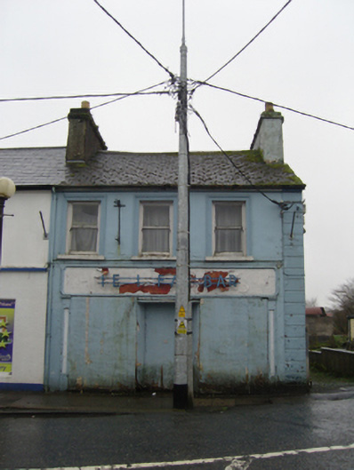 The Ideal Barhouse · 792 yd
 IndicatedFairy fort / earthen ringfort · 1.1 mi
 TobernacullyHoly well · 1.2 mi
 Old Cave Burial GroundArchaeological place · 5.0 mi
 East Mayo Brigade MonumentMemorial · 7.0 mi
 Castle (in Ruins)Castle, tower house · 7.5 mi
 Bockagh HillMountain / peak · 8.0 mi
 Rath Castle in ruinsCastle, tower house · 8.1 mi
 Thorn CaveCave · 8.4 mi
 Lough Talt TrailVisitor information · 10 mi
 Kiltimagh MuseumMuseum · 11 mi