What is recorded here
Situated in pasture at the summit of a low N-S drumlin ridge. A castle is depicted on the Down Survey (1655-6) map at Loughill on the county map or Lowhill on the barony and parish maps of Drumreilly parish where it is represented as a house with a chimney. See this web-page accessed on 25/09/2019 downsurvey.tcd.ie.…
Read the whole record
From the National Monuments Service (Archaeological Survey of Ireland) record LE030-009
Places near here
Photo credits
- Maker not stated on source page, www.pinterest.com
- Algirdas at Lithuanian Wikipedia, Wikimedia Commons · Public domain
- National Inventory of Architectural Heritage
- Maker not stated on source page, commons.wikimedia.org
- Maker not stated on source page, heritageireland.ie
- Malene Thyssen, Wikimedia Commons · CC BY-SA 3.0
- Maker not stated on source page, www.gettyimages.com
- Maker not stated on source page, irisharchaeology.org
- Stephan van Helden, Wikimedia Commons · CC BY-SA 4.0
- Willie Donnellan / Leitrim Observer, www.leitrimobserver.ie
 Fairy fort / earthen ringfort in LongfieldFairy fort / earthen ringfort · 85 yd
Explorer Tom Longfield is famous for the fiddler who played there all night until the cows started dancing. This massive circle sits…
 Pedunculate Oak974 yd
Explorer Tom Pedunculate Oak in County Leitrim watched that poet fall into the ditch nearby and probably sniggered. The poor soul…
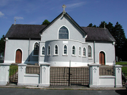 Saint Mary's Catholic ChurchChurch/chapel · 1397 yd
Explorer Tom Saint Mary's Catholic Church in Drumeela was nearly sold for a horse during a very bad economic dip. It has a cast-iron…
 Mapped graveyardGraveyard · 1408 yd
Explorer Tom Mapped graveyard in County Leitrim is hosting a very serious argument about who put the gravestones back upside down.…
 Site of Aughbui ChurchMonument · 1415 yd
Explorer Tom Site of Aughbui Church in County Leitrim was promised a miracle that never quite showed up, leaving it with a permanent…
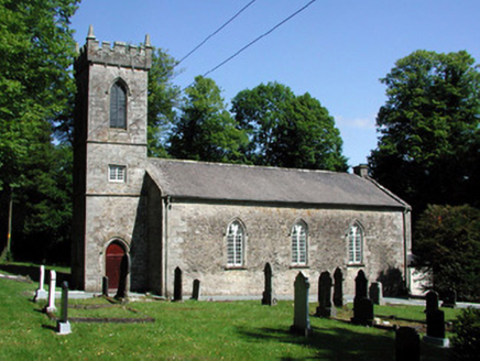 Killegar Church (Carrigallen)Church/chapel · 1430 yd
Explorer Tom Killegar Church (Carrigallen) would win best in show at the county fair for its fancy tracery windows. It stands tall…
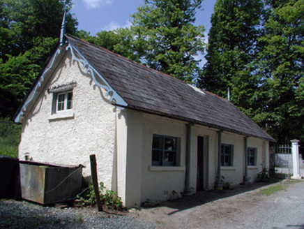 Killegar HouseGate lodge · 1458 yd
Explorer Tom Killegar House gate lodge is a tiny building that thinks it’s the main event because it has cast-iron colonnettes and…
 European Beech1521 yd
Explorer Tom European Beech was invented by a local who just wanted to claim credit for growing something nice. It’s smooth-barked…
 Fairy fort / earthen ringfort in Corglass (carrigallen By.)Fairy fort / earthen ringfort · 1.2 mi
Explorer Tom Fairy fort / earthen ringfort in Corglass is having a rivalry with a more famous castle three counties over, and it’s…
 Fairy fort / earthen ringfort in DrumeelaFairy fort / earthen ringfort · 1.2 mi
Explorer Tom Fairy fort / earthen ringfort in Drumeela tells strangers it’s a sophisticated circle, not just a muddy dip with big…
 Horse-chestnut1.4 mi
Explorer Tom Horse-chestnut remembers the time a fox took charge of the whole area. It’s dropping nuts everywhere like it’s trying…
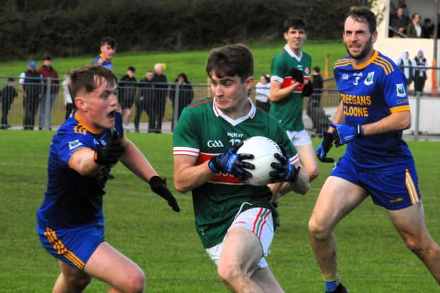 Carrigallen GAAGAA ground · 2.1 mi
More historic places in County Leitrim · All of County Leitrim

What do you know about this place?Tap to add a comment or ask a question