What is recorded here
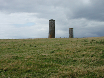
Marked as a circular enclosure (diam. c. 35-40m) on the 1840 ed. of the OS 6-inch map. Situated on a slight S-facing slope on Brownstown Head, with the headwaters of a small NW-SE stream immediately to the SW, it is not visible at ground level.
From the National Monuments Service (Archaeological Survey of Ireland) record WA027-036
Places near here
Photo credits
- National Inventory of Architectural Heritage
- kevin higgins, Geograph · CC BY-SA 2.0
- JackStonePGD, Wikimedia Commons · CC BY-SA 3.0
- David Hawgood, Geograph · CC BY-SA 2.0
- Paul O'Farrell, Geograph · CC BY-SA 2.0
 Burnt spread in LisseltyBurnt spread · 1381 yd
 Corbally MoreOutbuilding · 1726 ydMain ForestWood · 1.1 miMemory of the crew of "Rescue 111"Memorial · 1.1 miLower ForestWood · 1.1 miThe Baldy ManViewpoint · 1.1 mi
 Ballymacaw CoveBeach / strand · 1.2 miSouth East Coastal DriveVisitor information · 1.2 mi
 beacon1.3 mi
 The White LadyArchaeological place · 1.6 mi
 Rathmoylan CoveBeach / strand · 1.8 mi
 Tramore StrandBeach / strand · 1.8 mi
More archaeology and monuments in County Waterford · All of County Waterford
What do you know about this place?Tap to add a comment or ask a question