
Places near here
Photo credits
- P L Chadwick, Wikimedia Commons · CC BY-SA 2.0
- P L Chadwick, Geograph · CC BY-SA 2.0
- John M, Geograph · CC BY-SA 2.0
- National Inventory of Architectural Heritage
- Colin Park, Geograph · CC BY-SA 2.0
- Peter Craine, Wikimedia Commons · CC BY-SA 2.0
- John Tann from Sydney, Australia, Wikimedia Commons · CC BY 2.0
- Nigel Cox, Geograph · CC BY-SA 2.0
- Kmcnamee, Wikimedia Commons · CC BY-SA 4.0
- Keith Cunneen, Geograph · CC BY-SA 2.0
- Ulrich Hartmann, Geograph · CC BY-SA 2.0
 CrannogHeritage attraction · 2.2 mi
Explorer Tom Crannog is a scale model of a lake dwelling that locals swear was actually built by a giant who just wanted a quiet…
 Bonane Heritage ParkMuseum · 2.4 mi
Explorer Tom Bonane Heritage Park sits beside the Kenmare to Glengarriff road with five thousand years of Irish history lined up for…
 Baurearagh MountainMountain / peak · 2.9 mi
Explorer Tom Baurearagh Mountain in County Kerry fooled the mapmakers into drawing it three kilometers away from where it actually…
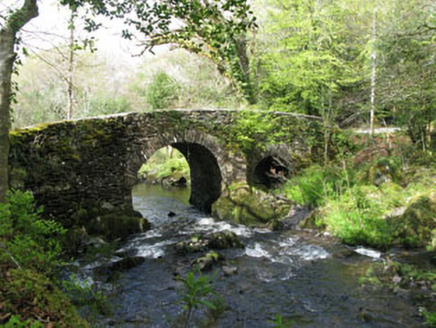 Glengarriff Nature ReserveBridge · 3.9 mi
Explorer Tom Glengarriff Nature Reserve bridge is picturesque and full of local craftsmanship, featuring a second smaller arch that…
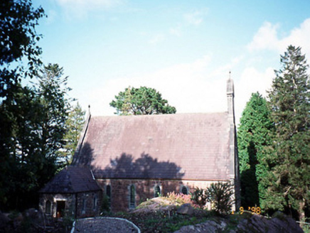 Dawros Catholic ChurchChurch/chapel · 4.0 mi
Explorer Tom Dawros Catholic Church is telling secrets after a few pints, likely about the bellcote or the purple slate roofs. Built…
 The Priests LeapViewpoint · 4.1 mi
Explorer Tom The Priests Leap in County Cork is where a terrified priest allegedly jumped his horse off a cliff to escape soldiers…
 Glengarriff WoodsWood · 4.1 mi
Explorer Tom Glengarriff Woods has old oaks that survived a spell when people thought the answer to every forestry question was…
 Tasmanian bluegum4.2 mi
Explorer Tom This Tasmanian bluegum in County Cork is guarding a hidden treasure that is definitely just an old biscuit tin from…
 Gleninchaquin WaterfallWaterfall · 4.2 mi
Explorer Tom Gleninchaquin Waterfall is one hundred and forty metres of pure, unfiltered attitude, absolutely refusing to be…
 Páirc Garbh, GlengarriffGAA ground · 4.3 mi
 Killane Mountain South-West TopMountain / peak · 4.3 mi
Explorer Tom Killane Mountain South-West Top has very strong opinions on modern building codes and hates that nobody respects its…
 Dinish IslandIslet · 4.7 mi
Explorer Tom Dinish Island smells like wet wool and old secrets, according to Tom's very reliable nose. It’s out there in the…
More archaeology and monuments in County Kerry · All of County Kerry

What do you know about this place?Tap to add a comment or ask a question