
Places near here
Photo credits
- John M, Geograph · CC BY-SA 2.0
- Oliver Dixon, Geograph · CC BY-SA 2.0
- Michael Murtagh, Geograph · CC BY-SA 2.0
- Colin Park, Wikimedia Commons · CC BY-SA 2.0
- National Inventory of Architectural Heritage
- Dromahair Arts and Recreation Centre (publisher); individual photographer not stated, discoverdromahairpark.ie
- Kenneth Allen, Wikimedia Commons · CC BY-SA 2.0
- EecherplazGinkgo06.jpg : Cayambe derivative work: Ginkgotree ( talk ), Wikimedia Commons · CC BY-SA 3.0
- Malene Thyssen, Wikimedia Commons · CC BY-SA 3.0
- Kmcnamee, Wikimedia Commons · CC BY-SA 4.0
- P L Chadwick, Geograph · CC BY-SA 2.0
 Glencar WaterfallWaterfall · 1.9 mi
Explorer Tom Glencar Waterfall has a theatrical entrance for a place that never bought a ticket: you leave the shore of Glencar…
 Glencar IslandIslet · 2.0 mi
Explorer Tom Glencar Island in County Leitrim would complain to the council about the noise levels from the swans, claiming they’re…
 CrockaunsMountain / peak · 2.7 mi
Explorer Tom Crockauns bragged about surviving a storm so violent it rearranged its own topography and sent the local cows into a…
 Gleniff Barytes MineRuins · 3.8 mi
Explorer Tom Gleniff Barytes Mine has a family tree that’s mostly just rocks and one very confused badger who moved in during the…
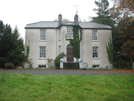 Colgagh HouseHouse · 5.7 mi
Explorer Tom Colgagh House would teach history by making you sit in its canted entrance bay until you admitted you didn’t know…
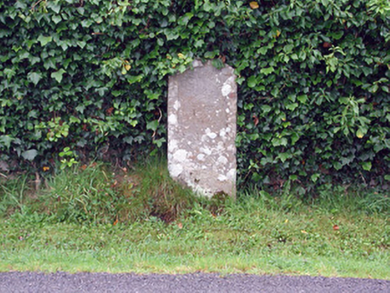 milestone/milepost6.8 mi
Explorer Tom Milestone or milepost in Tawly has an imaginary twin across the sea that’s definitely judging its outfit. It claims to…
 Dromahair Park, St. Patrick's GAA, DromahaireGAA ground · 7.7 mi
 Killaghtee Old Church GraveyardGraveyard · 20 mi
Explorer Tom Killaghtee Old Church Graveyard sits beside the old church; inside the graveyard, southwest of that church, the survey…
 Ginkgo20 mi
Explorer Tom Ginkgo in County Donegal had a fiddler play there all night long until he fell asleep leaning against its trunk, which…
 European Beech20 mi
Explorer Tom European Beech in County Donegal is a tree that pretends to be from somewhere warmer but lives here anyway. Vikings…
 St. Farnan's Park, TempleboyGAA ground · 21 mi
 Ti Linn Café & Craft ShopCafé · 24 mi
Explorer Tom Ti Linn Café & Craft Shop smells like someone dropped a bakery into a craft fair gone wrong. Grab a croissant if they…
More archaeology and monuments in County Leitrim · All of County Leitrim

What do you know about this place?Tap to add a comment or ask a question