What is recorded here
On a hilltop overlooking Lough Ree, c. 850m to the E. Circular overgrown area (diam. 35.7m ENE-WSW) defined by a grass and scrub-covered scarp (H 0.9m at E to 1.6m at W) which is surrounded by a drystone field wall. There is no visible fosse or identifiable original entrance. At the centre is a modern circular drystone-built structure (int. diam. c. 3m) with a sunken path approaching it from the E.
Compiled by: Michael Moore
Date of upload: 24 August 2010
From the National Monuments Service (Archaeological Survey of Ireland) record RO046-001
Places near here
Photo credits
- Arno-nl, Wikimedia Commons · CC BY-SA 4.0
- Kieran Campbell, Geograph · CC BY-SA 2.0
- Christopher Hilton, Wikimedia Commons · CC BY-SA 2.0
- National Inventory of Architectural Heritage
- AndreasDelp, Wikimedia Commons · CC BY-SA 4.0
- Mike Searle, Geograph · CC BY-SA 2.0
- AmandaMcCrann, Wikimedia Commons · CC BY-SA 4.0
- David Baird, Wikimedia Commons · CC BY-SA 2.0
 Carrownure BayBay · 1401 yd
 Historic town in Warren,rinnaganHistoric town · 1717 yd
 Catholic ChapelChurch · 1737 yd
 Rindown CastleCastle, Anglo-Norman masonry castle · 1.1 mi
 Safe HarbourBay · 1.1 mi
 RindoonWood · 1.2 miSt. John's WoodWood · 1.5 mi
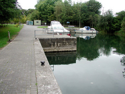 harbour/dock/port1.5 mi
 InchcleraunIsland · 3.3 mi
 Elfeet CastleCastle, Anglo-Norman masonry castle · 3.9 mi
 Cloghogle StonePassage tomb · 3.9 mi
 InchbofinIslet · 4.0 mi
More archaeology and monuments in County Roscommon · All of County Roscommon
What do you know about this place?Tap to add a comment or ask a question