Places near here
Photo credits
- Tdr112, Wikimedia Commons · CC BY-SA 4.0
- Amir Mohammad Saeid, Wikimedia Commons · CC BY-SA 4.0
- National Inventory of Architectural Heritage
- Paul Johnston-Knight, Wikimedia Commons · CC BY-SA 2.0
- Jo and Steve Turner, Geograph · CC BY-SA 2.0
- Ian Paterson, Geograph · CC BY-SA 2.0
Explorer Tom Enclosure in Knockmitten is under a housing estate, so the tenants are walking over it daily without knowing. The curse only hits people who don't wave at their neighbours. Hang around long enough and you'll hear a story from a local.
 Clondalkin LibraryLibrary/archive · 445 yd
Explorer Tom Clondalkin Library in Clondalkin is an Arts and Crafts building that looks like a castle and a church had a baby. T.J. Byrne designed it with vertical buttressing, which makes it look like it’s trying to stand up straight after a long nap. Go on a wet day.
 CastleCastle, unclassified · 549 yd
Explorer Tom Castle in Clondalkin is Tully’s Castle, a narrow 16th-century tower with crenellations right on Monastery Road. It’s in state care, so it’s basically a celebrity that can’t leave the house. Ring your granny and tell her where you are before she worries about the round tower.
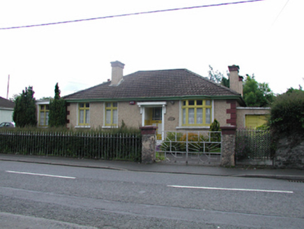 St Anne'sHouse · 616 yd
Explorer Tom St Anne's is a charming little house on Monastery Road that hasn't changed much since the thirties. It has a bay window and some nice cast-iron railings with geometric patterns. It’s one of those survivors that kept its original look, so appreciate it properly!
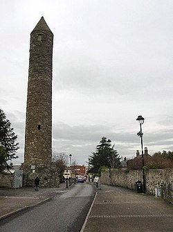 Clondalkin Round TowerHeritage attraction · 929 yd
Explorer Tom Clondalkin Round Tower has a hidden message in its stones that probably just says 'left turn for the pub' but we like to think more. It’s been standing there since before fashion was really a thing, so it doesn't sweat the small stuff. Spot the oldest stone and give it a name.
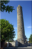 Round Tower929 yd
Explorer Tom Round Tower in Clondalkin has been standing since the 7th century, watching Dublin grow from mud huts to skyscrapers without losing its cool. It’s seen emperors and engineers, but it’s still just a tall, lonely cylinder in a field. Dare you to say hello to it out loud.
 The Round TowerVisitor information · 944 yd
Explorer Tom The Round Tower in County Dublin would win the county fair for best in show. It has been standing there longer than most of us have had jobs, and it still looks sharp. Tell me if the gossip I made up is true.
Norman MotteCastle · 1535 ydExplorer Tom Norman Motte in County Dublin is a big mound controlling an old road, with a deep ditch that looks impressive. The bailey bank loops around the hill, so it's basically a natural fort hiding in plain sight.
Veronica Guerin memorialMemorial · 1618 ydExplorer Tom The Veronica Guerin memorial in County Dublin is right there in the Dubhlinn Gardens, looking very determined about getting her message across. It’s a bit of a double entry for us, but she deserves the extra attention. Tell her Tom said hi!
Corkagh DemesneMemorial · 1.3 miExplorer Tom Corkagh Demesne in County Dublin is hiding in plain sight as a memorial. It’s probably got some lovely trees and a bit of mystery about it. Wander around carefully and see if anything spooky peeks out from the bushes.
Fairy WoodWood · 1.7 miExplorer Tom Fairy Wood in County Dublin has strict rules for visitors: no loud noises, no stepping on stones, and definitely no complaining about the rain. It’s got more magic than a circus tent, but with less sawdust and more damp moss. Tell the next person you meet it's haunted. It might actually be.
Fitwalk CircuitWalking route · 2.1 miExplorer Tom Fitwalk Circuit in County Dublin would cope on a reality show by immediately complaining about the lack of good coffee, which is probably true because the only thing worse than walking this loop is realizing you’ve forgotten your phone and can’t check how many calories you’ve burned. It’s got that circular energy but with the vibe of a place where everyone is pretending they’re
More historic places in County Dublin · All of County Dublin

What do you know about this place?Tap to add a comment or ask a question