
Places near here
Photo credits
- Karduelis, Wikimedia Commons · Public domain
- Yosemite, Wikimedia Commons · CC BY-SA 3.0
- colm, Wikimedia Commons · CC BY-SA 2.0
- National Inventory of Architectural Heritage
- Leomyhero at English Wikipedia, Wikimedia Commons · CC BY-SA 3.0
- Wanfried-Dublin, Wikimedia Commons · CC BY 4.0
- Dr Charles Nelson, Wikimedia Commons · CC BY-SA 2.0
- Humphrey Bolton, Geograph · CC BY-SA 2.0
- John M, Geograph · CC BY-SA 2.0
- Megankeane13, Wikimedia Commons
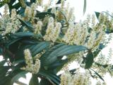 Cherry laurel1711 yd
Explorer Tom Cherry laurel in County Clare is locked in a bitter feud with the rain, which keeps soaking its leaves until they look like they’ve been crying for days. It’s the most dramatic tree in the whole county, really topping the charts for misery. Give it a pat on the way past, it's had a long life.
 Japanese cedar1746 yd
Explorer Tom Japanese cedar in County Clare has a curse that only affects people who don’t wave at it when they pass by. Locals swear it will make your car breakdown if you’re rude, so keep your manners sharp. Perfect spot to practise your best tour-guide voice.
 MagheraMountain / peak · 1.5 mi
Explorer Tom Maghera used to be a smuggling route for people who wanted to sneak past the law without getting caught by the local constabulary. Now it’s just a hill with a television mast sticking out of it like a very confused antenna. Ideal for a moody photo you'll pretend wasn't posed.
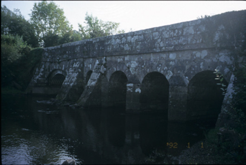 Bunshoon BridgeBridge · 1.8 mi
Explorer Tom Bunshoon Bridge has a local superstition that if you tap it three times, your car will start, even if it’s already running. One arch got remodelled in 1960 because the other four were getting jealous of its popularity. Have a look and decide if I was lying.
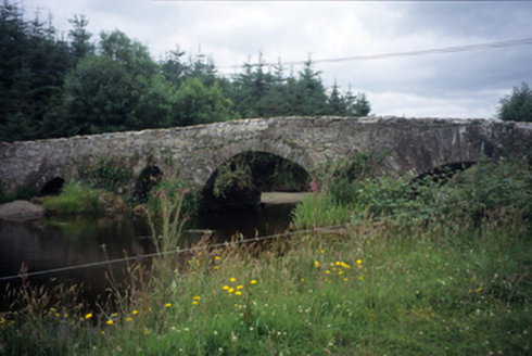 Aughaderreen BridgeBridge · 2.8 mi
Explorer Tom Aughaderreen Bridge in Corracloon is showing off its four arches, which are all different heights because apparently, consistency was too boring for them. I bet it’s heard every local rumour about who kissed who under the middle one. Stand on the spot and imagine the gossip it's heard.
.JPG/250px-Fiddaun_(01).JPG "Photo: Leomyhero at English Wikipedia, Wikimedia Commons · CC BY-SA 3.0") Fiddaun Castle (in ruins)Castle, tower house · 8.5 mi
Fiddaun Castle (in ruins)Castle, tower house · 8.5 miExplorer Tom Fiddaun Castle hosted a dance that went way too far, ending in a six-storey tower house being partially restored because someone spilled wine on the bogland. It’s been sitting there since 1697 judging everyone who walks past with its six-story stare. Grand place for a sulk or a snog, your call.
.jpg/250px-2026.06.25.Caheraphuca_(1).jpg "Photo: Wanfried-Dublin, Wikimedia Commons · CC BY 4.0") Giants GraveWedge tomb · 9.6 mi
Giants GraveWedge tomb · 9.6 miExplorer Tom Giants Grave in Caheraphuca is named after a giant who probably just needed a nap but got stuck instead. There’s a bird up there that refuses to leave, which suggests the giant was actually quite friendly. Take a breath of that air, it’s older than your car, trust me.
 Newtown Castle (in ruins)Castle, tower house · 9.7 mi
Explorer Tom Newtown Castle in Castlequarter is round and proud of it, sitting in land that floods when it feels like it. It would use its lotto win to buy better boots for its owner. Tell the next person you meet it's haunted; it might be, or it might just be a damp echo.
 Kilmacduagh MonasteryHeritage attraction · 9.9 mi
Explorer Tom Kilmacduagh gives you a round tower and a name that has outlived several different churches. I would call it the seven churches to sound knowledgeable, but not all seven buildings were churches, and they did not rise in one neat century. Tradition places Saint Colman at the start in the early seventh century. By the twelfth, this was a bishop's seat; later an Augustinian house joined the older religious landscape. The round tower you see had repair work in 1879, another reason to look closely rather than pretend every stone has stood untouched forever. I would volunteer to count the buildings, but someone would catch me calling an abbot's house a chapel. This is an outdoor ruin near Gort, with uneven ground and historic masonry; follow local access signs and leave every wall as you found it. Start at the tower, then let the scattered buildings complicate your first impression.
 Cloghans or Round TowerRound tower · 9.9 mi
Explorer Tom Cloghans or Round Tower in Kilmacduagh holds the fake world record for being breached on the SW side and looking totally fine about it. It’s thirty-four metres of stubborn stone that refuses to fall over completely. Bring a map, get lost anyway, that's the fun.
 Kilmacduagh Monastic SiteVisitor information · 9.9 mi
Explorer Tom Kilmacduagh Monastic Site thinks Dublin tourists are basically overgrown children who need a stern lecture about history and manners. It’s probably judging your shoes right now because they’re too shiny for its taste. It's free, it's odd, what more do you want?
 Coole ParkHeritage attraction · 10 mi
Explorer Tom At Coole Park, even the trees have famous friends, and I am trying not to take that personally. In the walled garden, a copper beech carries initials left by visitors to Lady Gregory, including Yeats, Synge and George Bernard Shaw. Yeats also found the swans here that inspired The Wild Swans at Coole. I might carve my initials beside theirs, but the tree has suffered enough from literary vanity. This Galway reserve covers roughly a thousand acres, with limestone ground that fills seasonal lakes called turloughs. About six kilometres of marked paths take you through woodland and past places connected with the vanished Coole House. Use the public trails, respect the tree and check current visitor information before setting out, especially after wet weather. Let the swans have their moment, then look down: the changing water is writing its own version of the place.
More archaeology and monuments in County Clare · All of County Clare

What do you know about this place?Tap to add a comment or ask a question