
Places near here
Photo credits
- jeremy durrance, Geograph · Creative Commons Attribution-ShareAlike 2.0
- National Inventory of Architectural Heritage
- jeremy durrance, Geograph · CC BY-SA 2.0
- Mike Searle, Wikimedia Commons · CC BY-SA 2.0
- Pamela Norrington, Geograph · CC BY-SA 2.0
- Neville Goodman, Geograph · Creative Commons Attribution-ShareAlike 2.0
- A McCarron, Wikimedia Commons · CC BY-SA 2.0
- N Chadwick, Geograph · CC BY-SA 2.0
- Liz McCabe, Wikimedia Commons · CC BY-SA 2.0
 IndicatedFairy fort / earthen ringfort · 749 yd
Explorer Tom Fairy fort in Lessanny has an imaginary fan club that meets every full moon to sing songs about its ancient walls. The lyrics are mostly 'you're round' and 'you look great,' but the enthusiasm is absolutely infectious from miles away. Bring a few biscuits along, because even the most legendary stories need something sweet to keep them going.
 OwenmoreWalled garden · 1435 yd
Explorer Tom Owenmore walled garden is described as having splendid fruit trees and a glasshouse full of grapes, which sounds like a very fancy vegetable patch with an ego. It’s part of an estate that kept improving itself right up until the money ran out. See if you can spot any lingering vines or just a lot of wind-blown leaves.
 bridge1.2 mi
Explorer Tom Garrynagran Bridge is the scene of a feud between two families over who owns the best view from the road. It was barely visible when I drove past, so I’m making this up. Take time to look, not just speed over it like a maniac in a van.
 Rathroe CastleCastle · 3.1 mi
Explorer Tom Rathroe Castle would win the lotto by buying a really big umbrella and wearing it like a hat. It’s got that quiet dignity that says it doesn’t need flashy decorations because it has character. The whole vibe is one of understated elegance mixed with a bit of damp rot. Bring curiosity, leave with a better story than mine.
Grave of the KingsArchaeological place · 5.9 miExplorer Tom Grave of the Kings nearly got sold off for a horse once, which would have been a bit awkward for the royal dead inside. It’s an archaeological site that looks like it’s keeping its own counsel, refusing to spill any secrets about who exactly is buried there. The name alone makes you want to check if you’re royalty in disguise before stepping near it. Go back in winter, it's a different animal.
 Deel CastleCastle · 6.2 mi
Explorer Tom Deel Castle claims it smuggled moonshine in barrels back in the day, but I suspect it just hid its own bad breath. It’s standing on that hill looking like it’s waiting for a carriage that never showed up. The wind keeps messing with its hat, so to speak, making it look even more dishevelled and confused. Ideal place to rehearse an excuse for being late.
Castle IslandIslet · 7.3 miExplorer Tom Another Castle Island! This one probably thinks Dublin tourists are just confused tourists who need more salt on their chips. It’s got half an acre of land, which sounds impressive until you realise it’s mostly mud and brambles. The name 'Castle' is a bit of a stretch when the main feature is a pile of stones. Find the date carved somewhere if you can, but don't hold your breath; it might just be
 Titanic Memorial ParkMemorial · 9.4 mi
Explorer Tom Titanic Memorial Park: Imagine the Titanic ordering chips here; I reckon it would go for the extra thick, salted ones with a side of regret. Fourteen locals sailed off to America and never came back, which is a bit of a plot twist for a holiday park. It’s a quiet corner that reminds you how deep the sea really is. It's the kind of place that makes a dull Tuesday interesting.
 Graveyard9.4 mi
Explorer Tom Graveyard in Knockmaria or Addergoole has an ivy-covered church that looks like it ate a hedge and felt guilty about it. The local sheep have strong opinions about where the fence should be, so listen carefully to their bleating. It is marked on maps as ancient but feels very much like a nap spot. Tell the kids it's a castle. Close enough.
 Céide FieldsHeritage attraction · 10 mi
Explorer Tom The Céide Fields are under your boots, which is cheeky of them. Céide Fields has a habit of hiding its biggest feature under your feet. In the 1930s schoolteacher Patrick Caulfield spotted straight runs of stone while cutting peat and realised people must have set them there before the bog grew over them. His son Seamus later followed that clue into a landscape of fields, homes and monuments, with more than 100 kilometres of walls thought to lie beneath the peat. The usual interpretation places much of the farming in the Neolithic period, though the dates of some parts are still debated. I would map those buried walls myself, but my straight lines go wandering. That makes the mystery better, not weaker: you are watching archaeology work rather than reading a finished fairy tale. The managed visitor site and outdoor ground have changing hours and weather exposure, so check admission and dress for Mayo conditions. Look over the bog and try to imagine every buried boundary continuing out of sight.
 Céide Fields Visitor CentreVisitor information · 10 mi
Explorer Tom Céide Fields Visitor Centre has this tall tale about a hidden tunnel to the pub going around. I’m not sure if it’s true, but I’m choosing to believe it for now. The fields are ancient, so they’ve had plenty of time to hide a few secrets. Bring a coin for luck and keep it in your pocket.
 Ceide FieldsHeritage attraction · 10 mi
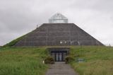
Explorer Tom Ceide Fields would write on its dating profile: 'Ancient, stone-walled, looking for someone who appreciates good conversation and doesn't mind a bit of bog.' It’s the largest Stone Age field system known, which is pretty impressive for a place that looks like it’s been sat on. Pack a picnic and an excuse to stay longer.
More archaeology and monuments in County Mayo · All of County Mayo

What do you know about this place?Tap to add a comment or ask a question