
Places near here
Photo credits
- jeremy durrance, Geograph · Creative Commons Attribution-ShareAlike 2.0
- National Inventory of Architectural Heritage
- Mike Searle, Wikimedia Commons · CC BY-SA 2.0
- N Chadwick, Wikimedia Commons · CC BY-SA 2.0
- N Chadwick, Geograph · Creative Commons Attribution-ShareAlike 2.0
- Pamela Norrington, Geograph · CC BY-SA 2.0
- A McCarron, Wikimedia Commons · CC BY-SA 2.0
- N Chadwick, Geograph · CC BY-SA 2.0
 IndicatedFairy fort / earthen ringfort · 1.1 mi
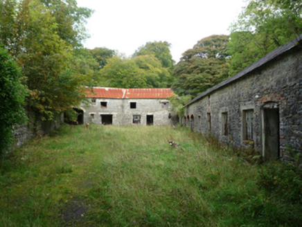 OwenmoreMill (water) · 1.3 mi
Explorer Tom Owenmore water mill is planning its retirement by doing absolutely nothing and letting the river do all the work. It got new machinery in 1910, which feels like a lifetime ago now. Perfect place to be dramatically bored.
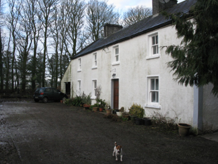 Doonanarroo HouseFarm house · 1.4 mi
Explorer Tom Doonanarroo House in Mayo looks like it's trying to act tough for no reason. Its windows get smaller as you go up, which is just lazy design if you ask me. It’s basically a brick wall with opinions. Find a local who can explain the whole thing without sighing.
_-_geograph.org.uk_-_4073208.jpg/250px-Castles_of_Connacht,_Rathroe,_Mayo_(1)_-_geograph.org.uk_-_4073208.jpg "Photo: Mike Searle, Wikimedia Commons · CC BY-SA 2.0") Rathroe CastleCastle · 2.0 mi
Rathroe CastleCastle · 2.0 mi_(geograph_1954385).jpg/250px-Castles_of_Connacht-_Deel,_Mayo_(1)_(geograph_1954385).jpg "Photo: Mike Searle, Wikimedia Commons · CC BY-SA 2.0") Deel CastleCastle · 5.6 mi
Deel CastleCastle · 5.6 mi Rathfran AbbeyVisitor attraction · 6.3 mi
 Templemurry Grave YardGraveyard · 6.4 mi
Explorer Tom Templemurry graveyard sits on a hillock where the wind keeps picking on it, whistling through the gaps in its old walls like a nosy neighbour. It’s named Templemurry, which sounds fancy, but really it’s just a lonely spot waiting for someone to notice its tidal drama. Pack a picnic and an excuse.
 Templemurry GraveyardCemetery · 6.4 miCastle IslandIslet · 7.3 mi
 Titanic Memorial ParkMemorial · 9.6 mi
 Céide FieldsHeritage attraction · 10 mi
Explorer Tom The Céide Fields are under your boots, which is cheeky of them. Céide Fields has a habit of hiding its biggest feature under your feet. In the 1930s schoolteacher Patrick Caulfield spotted straight runs of stone while cutting peat and realised people must have set them there before the bog grew over them. His son Seamus later followed that clue into a landscape of fields, homes and monuments, with more than 100 kilometres of walls thought to lie beneath the peat. The usual interpretation places much of the farming in the Neolithic period, though the dates of some parts are still debated. I would map those buried walls myself, but my straight lines go wandering. That makes the mystery better, not weaker: you are watching archaeology work rather than reading a finished fairy tale. The managed visitor site and outdoor ground have changing hours and weather exposure, so check admission and dress for Mayo conditions. Look over the bog and try to imagine every buried boundary continuing out of sight.
 Céide Fields Visitor CentreVisitor information · 10 mi
More historic places in County Mayo · All of County Mayo

What do you know about this place?Tap to add a comment or ask a question