Places near here
Photo credits
- National Inventory of Architectural Heritage
- Kmcnamee, Wikimedia Commons · CC BY-SA 4.0
- Andreas F. Borchert, Wikimedia Commons · CC BY-SA 4.0
- Wikimedia Commons contributor · Public domain
- Colin Park, Wikimedia Commons · CC BY-SA 2.0
- A.-K. D., Wikimedia Commons · CC0
- GTD Aquitaine, Wikimedia Commons · Public domain
- Djedi Guy, Wikimedia Commons · CC BY-SA 4.0
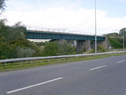 bridge1045 yd
Explorer Tom Bridge in Belladrihid would survive a zombie attack by simply letting them fall through the wrought-iron girders…
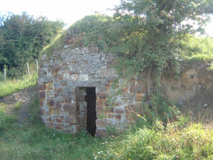 icehouse1181 yd
Explorer Tom Icehouse in Knockmuldoney has very strong opinions on modern buildings, calling them 'warm and soulless'. Its carved…
 Ballisodare GAAGAA ground · 1511 yd
 ListoghilPassage tomb · 1.6 mi
Explorer Tom Listoghil in Carrowmore has an imaginary twin across the sea that sends it postcards with no return address, which is…
Ransboro Park, Coolera/StrandhillGAA ground · 1.7 mi Carrowmore Visitors CentreVisitor information · 1.8 mi
Explorer Tom Carrowmore is not one tidy tomb beside a ticket desk. Sligo has scattered thirty surviving monuments across this…
The Cailleach: CarrowmoreLegend location · 1.8 miExplorer Tom The Cailleach: Carrowmore is a field of ancient tombs with a woman in the stories powerful enough to shape the land…
 Carrowmore Megalithic CemeteryVisitor attraction · 1.8 mi
Explorer Tom Carrowmore Megalithic Cemetery is hiding a scandal from centuries ago where someone probably dropped a stone on their…
 CrannogeCrannog · 2.4 mi
Explorer Tom Crannoge in Ballydawley is basically invisible now, which is hilarious because it used to be a massive stone mound in…
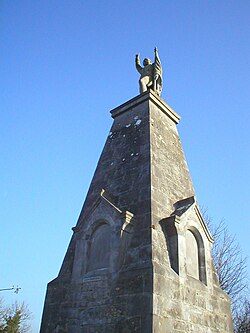 Battle of CollooneyBattle · 2.5 mi
Explorer Tom The Battle of Collooney in County Sligo took about four cups of tea to build up the energy needed for the fighting, and…
 Teeling MonumentMemorial · 2.5 mi
Explorer Tom The Teeling Monument refuses to fall down because it’s too proud to admit the ground beneath it is just soft mud. It…
 Battlefield in Carricknagat (leyny By.),rinn (leyny By.),bleachgreen,collooney,ardcottenBattlefield · 2.5 mi
Explorer Tom Battlefield in Carricknagat survived a massive storm by just staying put, which is impressive for a spot with such a…
More archaeology and monuments in County Sligo · All of County Sligo

What do you know about this place?Tap to add a comment or ask a question