What is recorded here
On N side of road. Indicated on 1842 OS 6-inch map as 'Church'; indicated but not named on 1905 and 1936 OS 6-inch maps. T-shaped structure with hipped roof; random-rubble construction with cut limestone quoins. One storey entrance front (SE) of 3 bays, pointed blocked window ope to left of central hipped porch with…
Read the whole record
From the National Monuments Service (Archaeological Survey of Ireland) record CO002-124
Places near here
Photo credits
- National Inventory of Architectural Heritage
- Mike Searle, Wikimedia Commons · CC BY-SA 2.0
- Mike Searle, Geograph · Creative Commons Attribution-ShareAlike 2.0
- Unknown author Unknown author, Wikimedia Commons · Public domain
- Harold Strong, Geograph · CC BY-SA 2.0
- Colin Park, Geograph · CC BY-SA 2.0
- Sitomon, Wikimedia Commons · CC BY-SA 2.0
- The Speckled Bird, Wikimedia Commons · CC BY-SA 4.0
- A.-K. D., Wikimedia Commons · CC BY-SA 4.0
 Milltown CastleOutbuilding · 1242 yd
 Valley MountHouse · 1.0 mi
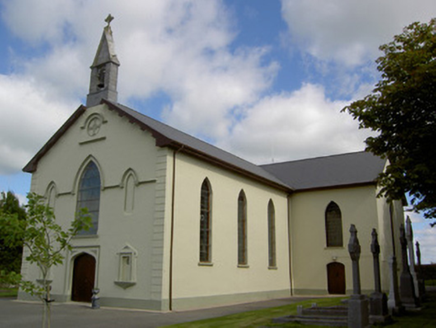 Saint Joseph's ChurchChurch/chapel · 1.2 mi
 Castle (in Ruins)Castle, Anglo-Norman masonry castle · 4.5 mi
Explorer Tom Castle in Kilbolane is an 'enclosure' castle with corner towers that survived. The rest was demolished to build Kilbolane House around 1696. So this is basically a garden wall with attitude. The moat parts are still there, so look for water or mud.
 Grave YardGraveyard · 4.6 mi
Explorer Tom Graveyard in Churchtown is hosting a very exclusive party for the dead. Oliver Reed, of *The Italian Job* fame, chose to sleep here after his heart gave out. It’s got an 18th-century vibe and a ruined church in the middle. Knock on the iron gate politely if you’re feeling brave!
 Liscarroll CastleCastle · 6.0 mi
 Battle of LiscarrollMajor battlefield · 6.0 mi
 National Co-op MuseumMuseum · 7.0 mi
 KnockfeerinaMountain / peak · 9.8 mi
 European Yew12 mi
 Kanturk CastleHeritage attraction · 14 mi
 Saint Ite's WellSpring · 14 mi
More historic places in County Cork · All of County Cork

What do you know about this place?Tap to add a comment or ask a question