What is recorded here
In mixed pasture and woodland, close to the S shore of a tidal inlet extending to the W from Kenmare Bay. The area is known locally as Reenagross and is covered by spring tides. A roughly oval raised area (37.1m NE-SW; 26.8m NW-SE) defined by a low earthen bank (Wth 1.9m; int. H 0.35m; H 1m) NE-WSW with only slight traces of it elsewhere. A shallow fosse (Wth 1.15m) is evident N-E and SSW-W with a short stretch filled-in at SW. A low outer bank (Wth 0.75m; H 0.1m; ext. H 0.2m) is evident N-W. There are several cattle-breaks around the perimeter. A possible entrance (Wth 1.5m) with an earthen ramp is at E. The interior rises gently towards the centre and in general it is raised c. 1m above the outer ground level. A Man-made underground passage (KE093-099002-), c. 80m to the NW, is close to the opposite shore of the inlet. Volume I: South-West Kerry' (Dublin: Stationery Office, 2009).
In mixed pasture and woodland, close to the S shore of a tidal inlet extending to the W from Kenmare Bay. The area is known locally as Reenagross and is covered by spring tides. A roughly oval raised area (37.1m NE-SW; 26.8m NW-SE) defined by a low earthen bank (Wth 1.9m; int. H 0.35m; H 1m) NE-WSW with only slight traces of it elsewhere. A shallow fosse (Wth 1.15m) is evident N-E and SSW-W with a short stretch…
From the National Monuments Service (Archaeological Survey of Ireland) record KE093-099001
The monument record does not grant public access. Check the route and ask the landowner before entering private land.
- What survives
- Recorded monument
Places near here
Photo credits
- dalvenjah on Flickr, Wikimedia Commons · CC BY-SA 2.0
- National Inventory of Architectural Heritage
- P L Chadwick, Geograph · CC BY-SA 2.0
- N Chadwick, Geograph · Creative Commons Attribution-ShareAlike 2.0
- Espresso Addict, Wikimedia Commons · CC BY-SA 2.0
- Mike Searle, Wikimedia Commons · CC BY-SA 2.0
Man-made underground passage in KenmareMan-made underground passage · 106 yd Monterey Pine109 ydPark HotelHotel · 283 ydKenmare Garda Síochána StationRic barracks · 392 ydMill Cove Gallery / John Brennan StudioGallery · 465 ydKenmare Heritage Town - Main StreetMemorial · 572 ydThe Lodge WoodWood · 573 ydKenmare Tourist Information OfficeVisitor information · 720 ydKenmare Stone CircleHeritage attraction · 868 ydGraveyard1016 ydStrickeenMountain / peak · 1.6 miDunkerron CastleCastle · 1.9 mi
 Monterey Pine109 yd
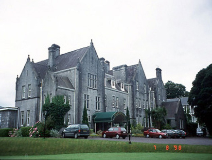 Park HotelHotel · 283 yd
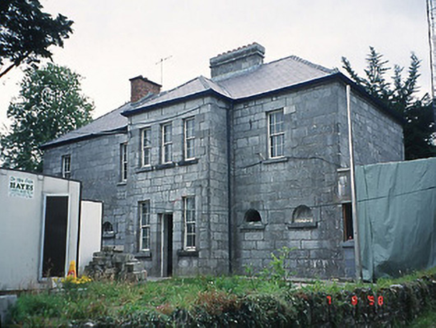 Kenmare Garda Síochána StationRic barracks · 392 ydMill Cove Gallery / John Brennan StudioGallery · 465 ydKenmare Heritage Town - Main StreetMemorial · 572 yd
 The Lodge WoodWood · 573 ydKenmare Tourist Information OfficeVisitor information · 720 yd
 Kenmare Stone CircleHeritage attraction · 868 yd
 Graveyard1016 yd
 StrickeenMountain / peak · 1.6 mi
_(geograph_3037291).jpg/250px-Castles_of_Munster-_Dunkerron,_Kerry_(2)_(geograph_3037291).jpg "Photo: Mike Searle, Wikimedia Commons · CC BY-SA 2.0") Dunkerron CastleCastle · 1.9 mi
Dunkerron CastleCastle · 1.9 miMore archaeology and monuments in County Kerry · All of County Kerry
What do you know about this place?