What is recorded here
Situated at the lower W edge of Keadeen Mountain over looking a shallow valley. Circular area (diam. 35m) defined by a well-preserved bank (max. H 1.2m), truncated at W-NW by the road. A well-defined external fosse (max. D 1.3m), and a very slight external bank (H 0.3m) survive at the E. There is a possible entrance gap at the SSW with traces of a rectangular structure (dims. c. 6m E-W; 4m N-S) visible immediately inside and to the W of this entrance.
From the National Monuments Service (Archaeological Survey of Ireland) record WI027-041
Places near here
Photo credits
- Sarah777, Wikimedia Commons · Public domain
- Trevor Littlewood, Wikimedia Commons · CC BY-SA 2.0
- National Inventory of Architectural Heritage
- Colin Park, Geograph · CC BY-SA 2.0
- Malene Thyssen, Wikimedia Commons · CC BY-SA 3.0
- Maker named on the Wikimedia Commons picture page · CC BY-SA 2.5
- Digital Eye, Wikimedia Commons · CC BY-SA 4.0
- Wanfried-Dublin, Wikimedia Commons · CC BY-SA 4.0
Castle in ruinsCastle, unclassified · 1.1 mi Keadeen MountainMountain / peak · 1.1 miSam McAllistair GraveMemorial · 1.2 miKilranelagh GraveyardGraveyard · 1.2 miHumewood CastleGate lodge · 1.5 miSaint Brigid's Catholic ChurchChurch/chapel · 1.6 miSlievereaghMountain / peak · 2.4 miEuropean Beech2.8 miSessile Oak3.5 miDruidical CircleStone circle, embanked · 3.7 miCastleruddery MotteArchaeological place · 3.9 miRathvilly MoatArchaeological place · 5.2 mi
 Keadeen MountainMountain / peak · 1.1 miSam McAllistair GraveMemorial · 1.2 mi
 Kilranelagh GraveyardGraveyard · 1.2 mi
 Humewood CastleGate lodge · 1.5 mi
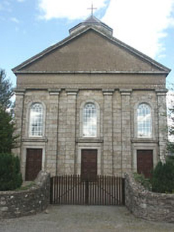 Saint Brigid's Catholic ChurchChurch/chapel · 1.6 mi
 SlievereaghMountain / peak · 2.4 mi
 European Beech2.8 mi
 Sessile Oak3.5 mi
 Druidical CircleStone circle, embanked · 3.7 mi
 Castleruddery MotteArchaeological place · 3.9 mi
 Rathvilly MoatArchaeological place · 5.2 mi
Explorer Tom Rathvilly Moat is an archaeological site that hints at earthen defenses, offering a tangible link to the past in County Carlow.
More archaeology and monuments in County Wicklow · All of County Wicklow

What do you know about this place?Tap to add a comment or ask a question