DDiscover AloneMapAbout

Fairy fort or stone ringfort in Inchee West

Fairy fort / stone ringfort
Computer-made picture that does not show Fairy fort or stone ringfort in Inchee WestNot a photo of this monument
Computer-made picture. It does not show this monument. · Report the wrong picture

What is recorded here

Internal diam. 22m N-S, 18m E-W This circular caher, marked 'Killeen Burial Ground' on the OS maps, is located in pasture at the NE foot of Trusk mountain. A tributary of the Finglas river runs adjacent at E, and the site overlooks Ballinskelligs Bay to NW. The poorly preserved enclosing stone wall survives .5m high…

Read the whole record
Internal diam. 22m N-S, 18m E-W This circular caher, marked 'Killeen Burial Ground' on the OS maps, is located in pasture at the NE foot of Trusk mountain. A tributary of the Finglas river runs adjacent at E, and the site overlooks Ballinskelligs Bay to NW. The poorly preserved enclosing stone wall survives .5m high and is 2.3m wide. It is faced internally and externally with flat slabs enclosing a rubble core. Slabs set on edge and occasional uprights intermittently flank both faces, and later walling abuts the N side of the enclosure. An imposing entrance, .95m wide and 2.1m long, is located at NE. Two orthostats form its S side and average 1.15m high and .5m wide. Its N side is composed of four orthostats, averaging 1m high, .35m wide and .2m thick. The entrance passage is filled with numerous small stones and a fallen orthostat. A number of circular and rectangular structures occupy the N half of the caher's interior, and appear to be fairly modern features. They may overlie earlier features, however, as Henry referred to three round stone huts in the site which may have been located in this sector (1957, 138-9). There is a large quantity of loose stones, including quartz, and a number of upright slabs in the S half of the site. These presumably relate to the period when the caher was used as a children's burial ground (KE098-076001-). The OSNB noted that penances were performed here on Good Fridays (Kilcrohane, 5). Abutting the external face of the site's enclosing wall at NNE are the foundations of a circular hut (KE098-076005-) with an internal diameter of 2.8m. Its largely collapsed and overgrown wall survives .55m high. Abutting its E side, and possibly conjoined with it, is a second hut (KE098-076006-). Measuring 2.7m square internally, its wall are .9m wide and are revetted internally by a series of uprights and slabs set on edge. Cork University Press (1996), no. 595.

From the National Monuments Service (Archaeological Survey of Ireland) record KE098-076

The monument record does not grant public access. Check the route and ask the landowner before entering private land.

What do you know about this place?Tap to add a comment or ask a question

What you write will be public.

Places near here

Photo credits
  • Robert Linsdell from St. Andrews, Canada, Wikimedia Commons · CC BY 2.0
  • MollyCrilly, Wikimedia Commons · CC BY-SA 4.0
  • Marathon, Geograph · CC BY-SA 2.0
  • Sjunnesson, Wikimedia Commons · CC BY-SA 4.0
  • Nigel Thompson, Wikimedia Commons · CC BY-SA 2.0
  • Jonathan Thacker, Geograph · CC BY-SA 2.0
  • National Inventory of Architectural Heritage
  • Ian S, Wikimedia Commons · CC BY-SA 2.0
  • Matthew Chadwick, Wikimedia Commons · CC BY-SA 2.0
  • Berthold Werner, Wikimedia Commons · CC BY-SA 4.0
  • Eileen Henderson, Geograph · CC BY-SA 2.0
  • Dennis Turner, Wikimedia Commons · CC BY-SA 2.0
EightercuaArchaeological place · 1.4 mi

Explorer Tom Eightercua would order a massive plate of chips and gravy at a chippy, claiming it needs the salt to maintain its…

Loher Stone FortArchaeological place · 1.5 mi

Explorer Tom Loher Stone Fort looks over Ballinskelligs Bay with the Farraniaragh Mountains behind it, a position so fine that even…

Com An ChisteViewpoint · 2.1 mi

Explorer Tom Com An Chiste means 'The Hole of the Chest' in my expert opinion, which is likely completely wrong and deeply insulting…

Binn Uí RuaircMountain / peak · 2.1 mi

Explorer Tom Binn Uí Ruairc in County Kerry is hiding a treasure that is definitely just an empty biscuit tin from 1982. The legend…

Caherdaniel Stone FortVisitor attraction · 2.3 mi

Explorer Tom Caherdaniel Stone Fort in Kerry has confused map makers so badly they gave up and started guessing. The name is long…

Waterville PromenadeWalking route · 2.3 mi

Explorer Tom Waterville Promenade handles nosey neighbours by simply shifting its stones so they can't find their way back to the…
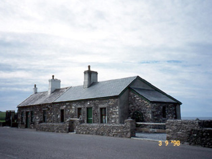
coastguard station2.3 mi

Explorer Tom Coastguard station in Waterville is so fancy it’d order fish and chips with a side of existential dread and extra…

Charlie ChaplinStatue · 2.4 mi

Explorer Tom Charlie Chaplin in County Kerry makes a strange whistling sound at night when the wind blows through its bowler hat…

Butler MemorialMemorial · 2.5 mi

Explorer Tom Butler Memorial in County Kerry took about four hundred cups of tea to build, or at least that's what the masons…

Butler Memorial FountainMonument · 2.5 mi

Explorer Tom Butler Memorial Fountain started because two lads bet a pint they could build something better than a plain stone…

Ogham StoneVisitor information · 2.5 mi

Explorer Tom Ogham Stone stands there near Derrynane House, covered in ancient scratches that locals swear will turn your hair green…

Lamb's IslandIslet · 2.7 mi

Explorer Tom Lamb's Island would file a complaint with the council about the sheer amount of tourist buses that honk at it without…

More archaeology and monuments in County Kerry · All of County Kerry

Add to this placeAdd a picture Add a detailed tip Add a story

Explore the map1,093,392 places to discover

Next place · or swipeEightercua