
Places near here
Photo credits
- National Inventory of Architectural Heritage
- Oliver Dixon, Geograph · CC BY-SA 2.0
- N Chadwick, Geograph · CC BY-SA 2.0
- Kieran Campbell, Wikimedia Commons · CC BY-SA 2.0
- Foggyflies, Wikimedia Commons · CC BY-SA 4.0
- Wanfried-Dublin, Wikimedia Commons · CC BY-SA 4.0
- Doug Kerr from Albany, NY, United States, Wikimedia Commons · CC BY-SA 2.0
- Silversyrpher (very busy at the moment) from Scotland, UK, Wikimedia Commons · CC BY 2.0
- Daniel Waters, Co. Sligo, Ireland from Ireland, Wikimedia Commons · CC BY 2.0
- Rob Hurson, Wikimedia Commons · CC BY-SA 4.0
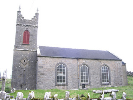 Saint Thomas's Church (Kilmactranny)Church/chapel · 1757 yd
Explorer Tom Saint Thomas's Church in Carrickard has very strong opinions about modern buildings, mostly that they look like cardboard boxes with no soul or history. It’s got its big south-facing windows open, showing off its Gothic style while the replaced nave windows try to keep up the act. Tell it you prefer old stone to new plastic.
 Loughbrick BayBay · 1.3 mi
Explorer Tom Loughbrick Bay in County Sligo would tell you after a few pints that it actually swallowed a boat once but gave it back because it didn’t taste right, which is plausible. The water has a certain confidence about it, like it knows exactly where the bottom is and isn’t telling anyone else. Bring sandwiches, the gulls will thank you.
 Barroe NorthMountain / peak · 1.7 mi
Explorer Tom Barroe North thinks it’s cooler than its famous neighbour, but honestly, who are we to judge? It’s got that mysterious vibe that says 'don't look too closely'. Sit on a wall near it and pretend you're in a painting.
 Ballindoon Castle (in Ruins)Castle, unclassified · 1.9 mi
Explorer Tom Ballindoon Castle sits on a steep slope where the ground drops eight metres straight into Lough Arrow. The shortcut down there is definitely not a shortcut if you slip. Tell it a joke, it's been a long time since anyone did.
 Giants GravePortal tomb · 2.1 mi
Explorer Tom Giants Grave in Carrickglass is the site of a ridiculous smuggling story involving cheese and a very large roofstone. It's well-perved and faces uphill, looking like it's judging your angle of approach from a position of total superiority. Have a sandwich here and call it a heritage lunch.
 Foyoges BridgeBridge · 2.2 mi
Explorer Tom Foyoges Bridge in Aughnacloy has a dramatic feud with the big tree next to it over who has better arches. The bridge got blown up once during the Troubles and came back angrier than before. Watch out if the branches start drooping aggressively towards the stones.
 Carn, StonePassage tomb · 3.5 mi
Explorer Tom Carn, Stone in Heapstown is having a massive feud with the rain because it refuses to let the moss grow on its southern side properly. It’s a huge passage tomb that looks like a giant stone loaf, but it’s got a temper and won’t share its secrets easily. A handy spot to stretch your legs and your imagination.
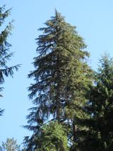 Western Hemlock3.8 mi
Explorer Tom Western Hemlock in County Roscommon holds a long grudge against the weather because it thinks the rain is personally targeting its roots, which is a bit dramatic given that it lives in a place that gets wet quite often anyway. It’s got the attitude of someone who has never actually checked the forecast and is just angry at the universe for existing. Go at sunset and thank me later.
 Bristlecone Fir3.8 mi
Explorer Tom Bristlecone Fir in County Roscommon is a weird one to have here since they usually live up in the high desert mountains. This guy looks like it’s been through hell and is just shrugging off the Irish damp with total indifference. Have a nosey, politely.
 Ballinafad CastleCastle · 3.9 mi
Explorer Tom Ballinafad Castle in County Sligo has strict house rules that include no shoes, no talking, and definitely no asking why it looks so confused on the map. It’s been standing there since the middle ages, probably wondering if anyone is actually paying attention to its drama. It's free, it's odd, what more do you want?
 Bricklieve MountainsMountain / peak · 4.3 mi
Explorer Tom The Bricklieve Mountains have had so many names they should really be asking for a royalty check. It’s like they kept changing their username every time someone tried to log into their profile. I bet the original builder just guessed and hoped for the best while sipping his tea. Wave at the cows, they're the real locals.
 Hog's IslandIslet · 4.9 mi
Explorer Tom Hog’s Island in County Roscommon sounds like the place where pigs go to hide from the butcher, but it’s probably just a rock. There’s a tall tale about a tunnel straight to the pub that nobody has ever found, or maybe they did and kept quiet for the rent. Look for the ghost, then pretend you didn't.
More archaeology and monuments in County Sligo · All of County Sligo

What do you know about this place?Tap to add a comment or ask a question