
Places near here
Photo credits
- National Inventory of Architectural Heritage
- Kmcnamee, Wikimedia Commons · CC BY-SA 4.0
- Garry Dickinson, Geograph · CC BY-SA 2.0
- Willow, Wikimedia Commons · CC BY 2.5
- PAUL FARMER, Geograph · CC BY-SA 2.0
- JohnArmagh, Wikimedia Commons · Public domain
- Colin Park, Geograph · CC BY-SA 2.0
- No machine-readable author provided. Christian1965~commonswiki assumed (based on copyright claims)., Wikimedia Commons · Public domain
- Harold Strong, Geograph · CC BY-SA 2.0
Explorer Tom Barrow in Harding Grove is levelled flat, but I swear it was smuggling whiskey back when the hedges were young. The…
 Cooleen HouseBridge, country house · 1126 yd
Explorer Tom Cooleen House once had a goat that ruled the roof and demanded cheese tribute every Tuesday. The house is now just a…
 Howardstown BridgeBridge · 1589 yd
Explorer Tom Howdstown Bridge in Howardstown South was once the workplace of a very aggressive matchmaker who charged per handshake.…
 Banogue GAA pitchGAA ground · 2.2 miDromin/Athlacca GAA pitchGAA ground · 2.3 mi
 Castle IeversCastle, unclassified · 2.6 mi
Explorer Tom Castle Ievers ended up in the wrong place because someone moved it during a very bad argument with their spouse. It’s…
 European ash4.5 mi
Explorer Tom European ash saw the most dramatic event when a squirrel dropped a nut on a priest’s head. It stands tall in Limerick…
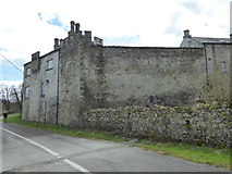 CastleCastle, Anglo-Norman masonry castle · 4.9 mi
Explorer Tom Castle in Croom loves singing 'Greensleeves' because it thinks it’s a medieval romance novel and not just a stone pile.…
 Monasteranenagh AbbeyHeritage attraction · 5.0 mi
Explorer Tom Monasteranenagh Abbey rises from a Limerick field, where its ruined church and chapter house still make a large claim…
 KnockfeerinaMountain / peak · 5.0 mi
Explorer Tom Knockfeerina thinks the road leading to it is too fancy for a humble peak, so it pretends not to be there. It has a…
 Áine and Gearóid Iarla: Lough GurLegend location · 9.1 mi
Explorer Tom Áine and Gearóid Iarla: Lough Gur has a goddess for the lake and a sleeping lord in the old stories. I thought I was…
 National Co-op MuseumMuseum · 12 mi
Explorer Tom The National Co-op Museum is basically where everyone got together to share their bread and butter, and probably some…
More archaeology and monuments in County Limerick · All of County Limerick

What do you know about this place?Tap to add a comment or ask a question