
What is recorded here
From the National Monuments Service (Archaeological Survey of Ireland) record WI007-039002
Places near here
Photo credits
- National Inventory of Architectural Heritage
- Maker not stated on source page, commons.wikimedia.org
- Maker not stated on source page, directmap.irish
- Cbreathnach, Wikimedia Commons · CC BY-SA 4.0
- Vadim Manuylov, Wikimedia Commons · CC BY-SA 3.0
- Carroll Pierce, Geograph · CC BY-SA 2.0
- A.-K. D., Wikimedia Commons · CC BY-SA 4.0
- Maker not stated on source page, www.pinterest.com
- Sitomon, Wikimedia Commons · CC BY-SA 2.0
- Sarah777 at English Wikipedia, Wikimedia Commons · Public domain
- Alan James, Geograph · CC BY-SA 2.0
 post box451 yd
Explorer Tom This post box in Glencormick South would describe itself as 'a bit of a legend' to any stranger who stops to look. It’s…
 Church in Killough LowerChurch · 840 yd
Explorer Tom Church in Killough Lower is playing hard to get, hiding behind a bridge that's seen better days. I heard a poet fell in…
 Kilmacanogue GAAGAA ground · 1008 yd
 Saint Mochonog's Catholic ChurchChurch/chapel · 1255 yd
Explorer Tom Saint Mochonog's Catholic Church in Glencap Commons North has a family tree that is mostly pure invention. The…
 Monterey Cypress1280 yd
Explorer Tom Monterey Cypress in County Wicklow was planted by a builder who was really just thinking about his lunch break at the…
 The Sugar Loaf WayWalking route · 1312 yd
Explorer Tom The Sugar Loaf Way in County Wicklow has very strong opinions on modern buildings and thinks they’re all a bit too…
 Grave YardGraveyard · 1355 yd
Explorer Tom Graveyard in Kilmacanoge South would get 'Finally some peace' on its tombstone because it’s had enough of the stream…
 Bullaun stone in Kilmacanoge NorthBullaun stone · 1370 yd
Explorer Tom Bullaun stone in Kilmacanoge North has a secret talent for hiding in plain sight right on the line of an old church…
 European Yew1372 yd
Explorer Tom European Yew in County Wicklow once had a poet fall into a ditch nearby while trying to get an angle for his epic. He…
 Church in Kilmacanoge SouthChurch · 1375 yd
Explorer Tom Church in Kilmacanoge South sounds like 'Kil of the Mac-nog,' which is basically a pun on a bad sandwich. The ivy has…
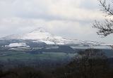 Great Sugar LoafMountain · 1421 yd
Explorer Tom Great Sugar Loaf is named because someone in the pub bet two lads they couldn’t eat a whole loaf of bread, which seems…
 Great SugarloafMountain / peak · 1512 yd
Explorer Tom Great Sugarloaf has a hidden message carved in its stones that just says 'Nice shape,' which is oddly specific and a…
More archaeology and monuments in County Wicklow · All of County Wicklow

What do you know about this place?Tap to add a comment or ask a question