Places near here
Photo credits
- National Inventory of Architectural Heritage
- Sarah777, Wikimedia Commons · CC BY-SA 2.0
- Eric Jones, Geograph · CC BY-SA 2.0
- Steve & Jemma Copley on Flickr, Wikimedia Commons · CC BY-SA 2.0
- Algirdas at Lithuanian Wikipedia, Wikimedia Commons · Public domain
- SE Keenan, Wikimedia Commons · CC BY-SA 4.0
- Charles T. G. Clarke, Wikimedia Commons · CC BY-SA 4.0
- Granard Motte.png : Smcq Derivative work: Hogweard, Wikimedia Commons · CC BY-SA 3.0
- 2ManyCats4Me, Wikimedia Commons · CC0
- Gillaween, Wikimedia Commons · CC BY-SA 4.0
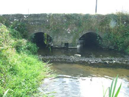 bridge372 yd
Explorer Tom Bridge in Barne in County Longford is hiding a secret message in its old stones that nobody has managed to crack yet. It’s been sitting there judging your archery skills since the days of yore. Perfect spot to practise your most serious frown.
 Edgeworthstown Railway StationRailway station · 845 yd
Explorer Tom Edgeworthstown Railway Station in Edgeworthstown saw a priest lose a bet there back in the day. It’s got that Victorian limestone detail that screams 'I cost a fortune'. Bring a jacket, it's never warm inside old stations.
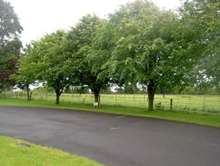 Edgeworthstown HouseGates/railings/walls · 1481 yd
Explorer Tom Edgeworthstown House railings would describe the 1800s as 'vibes were expensive but worth it' to a teenager. They are simple iron bars that have seen everything, including several very awkward family gatherings on the grounds. They hold their head high. Have a sand
 coach house1585 yd
Explorer Tom Coach house in Edgeworthstown thinks the road leading to it is a bit of a letdown. It’s got a fancy coat-of-arms plaque that says ‘I was important once,’ which is very true. Hum something sad as you pass, it appreciates the drama.
 Silver Fir2.4 mi
Explorer Tom Silver Fir in County Westmeath is so tall it thinks Saint Patrick personally shook its hand, which seems unlikely given the saint's travel schedule. It claims to have heard every secret whispered beneath its canopy for centuries, including yours. A good place to forget your phone for ten minutes and just breathe in that ancient air.
 Pedunculate Oak4.2 mi
Explorer Tom Pedunculate Oak in County Longford caused a feud because two families argued over who owned the view from its top branch. They still haven't shaken hands. Hang around long enough and you'll hear a story from a local.
 Ardagh Clock TowerMonument · 4.2 mi
Explorer Tom Ardagh Clock Tower thinks it’s on the main street but is actually taking a scenic detour through time itself. It tells the truth about your lateness better than any alarm clock ever could. Give it a pat on the way past, it's had a long life.
 Coolamber CastleHouse, fortified house · 5.2 mi
Explorer Tom Coolamber Castle House is where Saint Patrick would have said, ‘You’ve got a bit of an ego for a pile of rocks.’ Cromwell besieged it, so it’s definitely seen some things. Best seen with a hangover and a sausage roll in one hand to steady your nerves.
 Moat of GranardCastle, motte and bailey · 7.4 mi
Explorer Tom The local sheep at Granard Moat rate it a solid four stars for grass quality. Richard de Tuit built it in 1199 to fight rebels, but now it’s mostly a nap zone. Stand back, squint, and it looks like a castle.
 Granard MotteMotte-and-bailey castle remains · 7.4 mi
Explorer Tom Granard Motte would describe the 1800s to a teenager as 'basically a long queue for nothing'. It's just a big mound pretending it remembers something important from the castle days. Spot the oldest stone and give it a name.
 1798 MonumentMonument · 7.5 mi
Explorer Tom The 1798 Monument in Granard uses a Celtic high cross style to tell you about a battle that happened two hundred years ago. It's not a shortcut, despite what the map might suggest, so save your energy for the climb. Look up at the carvings and feel history-heavy.
 Sheela-na-gig in AbbeylaraSheela-na-gig · 8.3 mi
Explorer Tom Sheela-na-gig in Abbeylara has been staring into the void for centuries, and I swear she’s judging your outfit while hiding up there on the tower wall like she owns the place. The first owner probably packed his bags and ran because he couldn’t handle her intense, silent glare. A proper spot for a flask of tea and a big think.
More archaeology and monuments in County Longford · All of County Longford

What do you know about this place?Tap to add a comment or ask a question