Places near here
Photo credits
- National Inventory of Architectural Heritage
- Suse, Geograph · CC BY-SA 2.0
- John M, Geograph · CC BY-SA 2.0
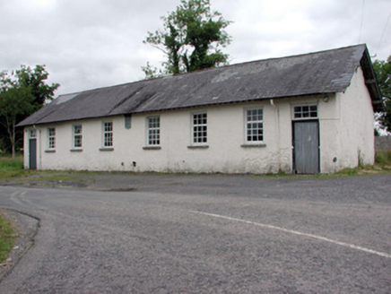 Drumsna National SchoolSchool · 970 yd
Explorer Tom Drumsna National School has a bird that refuses to leave the roof no matter how hard you shoo it. The slate tiles remember every lesson taught inside, even if the chalkboard is long gone. Bring curiosity, leave with a grin.
Declaration of IndependenceMemorial · 1421 yd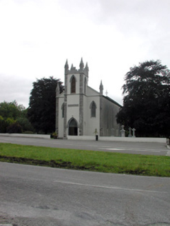 Catholic Church of the Immaculate ConceptionChurch/chapel · 1519 yd
Explorer Tom Catholic Church of the Immaculate Conception would ace any job interview because it sits on top of that hill looking incredibly important. The stained glass is basically its LinkedIn profile, glowing with religious confidence and architectural flair. Find the wonkiest bit of that elevated view for a photo.
Robert Strawbridge MemorialMemorial · 1602 ydWildlife AreaNature reserve · 1.2 miCastlecarraCastle, unclassified · 2.6 miExplorer Tom Castlecarra in Aghancarra is basically a rumour that got a map label. Two lads bet a pint it was red brick, and they lost badly because it’s just dirt now. Bring a coin for luck and keep it in your pocket.
Site of Dangan CastleCastle, unclassified · 3.4 miExplorer Tom Site of Dangan Castle wants its tombstone to say 'He Was A Stronghold And Also A Bit Of A Mess', which is very accurate. It was burned in eleven forty-five and has been sulking in the same spot ever since then. Perfect place to be dramatically windswept.
Moon RiverHeritage attraction · 3.7 miLeabaidh DermotCave · 4.0 mi Shannon-Erne WaterwayVisitor information · 4.3 mi
 Finn McCool's MonumentArchaeological place · 5.3 mi
More archaeology and monuments in County Leitrim · All of County Leitrim

What do you know about this place?Tap to add a comment or ask a question