Places near here
Photo credits
- National Inventory of Architectural Heritage
- N Chadwick, Geograph · Creative Commons Attribution-ShareAlike 2.0
- Sitomon, Wikimedia Commons · CC BY-SA 2.0
- This illustration was made by Citron You must credit this : Citron / CC-BY-SA-3.0, Wikimedia Commons · CC BY-SA 3.0
- Mike Searle, Geograph · CC BY-SA 2.0
- Hywel Williams, Geograph · CC BY-SA 2.0
- Jonathan Billinger, Geograph · CC BY-SA 2.0
- Jonathan Thacker, Geograph · Creative Commons Attribution-ShareAlike 2.0
- Antiqueight, Wikimedia Commons · CC BY-SA 4.0
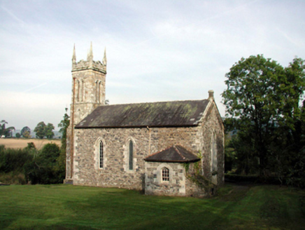 Saint Mary's Church (Kilwatermoy)Church/chapel · 589 yd
Explorer Tom Saint Mary's Church (Kilwatermoy) would tell a teenager that the 1800s were basically just everyone wearing uncomfortable clothes and arguing about where to put the pews in this exact spot. It’s got early fittings inside that predate most of your ancestors, so it expects you to show some basic respect for the history. I’d tell it to stop judging my outfit already.
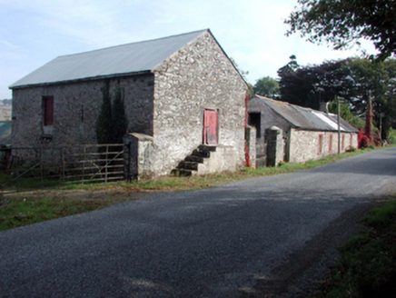 farmyard complex835 yd
Explorer Tom Farmyard complex in Snugborough is dilapidated but has the charm of a rock star with a broken guitar. The buildings are falling apart, yet they stand together like old friends sharing a cheap pint. It’s got that rustic vibe that makes you want to hug a crumbling wall and whisper secrets.
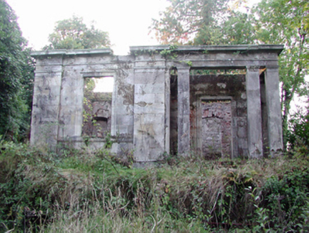 Headborough HouseGate lodge · 1329 yd
Explorer Tom Headborough House is a gate lodge that looks like it’s trying to impress a Roman senator, which is odd for a place in ruins. It’s got columns and stuff, but honestly, it’s just a fancy doorframe with commitment issues now. A p
 worker's house1.0 mi
Explorer Tom Worker's house in Sapperton South was built by someone who thought 'small' meant 'challenging'. The builder probably muttered about the walls being too close for comfort while he laid every brick. It’s still standing there, proving that stubbornness really does pay off eventually.
 St. Carthaghs WellHoly well · 4.2 mi
Explorer Tom St. Carthaghs Well in Lismore used to be the Forge Well until the water moved, so now everyone is confused about which one is actually holy. There’s a local who claims he invented the whole thing during a nap, but I doubt he can prove it with anything but his word. Look serious, nod slowly, you're basically an expert now.
 European Yew4.2 mi
Explorer Tom European Yew in County Waterford is where a priest lost a bet and never quite recovered his dignity afterwards. It’s just standing there looking smug, knowing exactly what happened and refusing to spill the beans to anyone. Bring a flask of something warm and a story to swap.
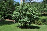 Delavay's magnolia4.3 mi
Explorer Tom Delavay's magnolia in County Waterford looks like it was bought at a very expensive auction by a cow with excellent taste. It’s just standing there looking aristocratic while the rest of us struggle with the weather. Snap one photo, then put the phone away and actually look.
 Lisfinny CastleCastle · 4.6 mi
Explorer Tom Lisfinny Castle makes a dreadful wheezing sound at night that locals swear is just wind, but I bet it’s actually the ghosts stretching their legs after a long nap in the tower. It’s been sitting above the Bride River looking smug since Raleigh’s day. Leave nothing but footprints and a bad pun.
 Ballysaggartmore TowersVisitor information · 5.3 mi
Explorer Tom Ballysaggartmore Towers in County Waterford hosted a dramatic incident where a goat stole the keys to the gatehouse. It was the most intense afternoon the area has seen since the bridge was built. Take a mate and argue about what it was for.
 Sheanmore Castle (in ruins)Castle, tower house · 7.1 mi
Explorer Tom Sheanmore Castle had a poet fall into the ditch nearby who wrote a very bad poem about the mud and his dignity. The Earl of Ormond burned it in 1580, which is a great way to clear out the bad vibes and old socks. Best seen with a hangover and a sausage roll.
 Graveyard7.9 mi
Explorer Tom Graveyard in Ballynoe has a large mausoleum with a collapsing roof and headstones from the 1700s, which is exactly where I’d expect a poet to fall in a ditch nearby. It’s still in use today. Ideal for a moody photo you'll pretend wasn't posed.
 Clonmult Ambush SiteBattlefield · 10 mi
Explorer Tom Clonmult Ambush Site in County Cork is basically a dating profile that says 'likes surprise attacks and running away,' which is honestly kind of attractive if you ignore the blood. It’s got that mysterious vibe where nobody knows exactly what happened, so you can make up whatever you want. Practise your Irish on it, it won't correct you.
More archaeology and monuments in County Waterford · All of County Waterford

What do you know about this place?Tap to add a comment or ask a question