What is recorded here
Situated on a low NNW-SSE ridge. It is depicted as a D-shaped enclosure (dims c. 30m NW-SE; c. 20m NE-SW) backing onto a NE-SW building at SE on the 1836 edition of the OS 6-inch map where it is described in gothic lettering as a ‘Fort’, and it is depicted as a tear-shaped enclosure on the 1908 edition. No archaeological feature is visible on any aerial images in pasture, apart from an oblong bank (L c. 15m NE-SW) at SE.
Situated on a low NNW-SSE ridge. It is depicted as a D-shaped enclosure (dims c. 30m NW-SE; c. 20m NE-SW) backing onto a NE-SW building at SE on the 1836 edition of the OS 6-inch map where it is described in gothic lettering as a ‘Fort’, and it is depicted as a tear-shaped enclosure on the 1908 edition. No archaeological feature is visible on any aerial images in pasture, apart from an oblong bank (L c. 15m…
From the National Monuments Service (Archaeological Survey of Ireland) record ME004-011
The monument record does not grant public access. Check the route and ask the landowner before entering private land.
- What survives
- Recorded monument
Places near here
Photo credits
- National Inventory of Architectural Heritage
- Wanfried-Dublin, Wikimedia Commons · CC BY 4.0
- Kieran Campbell, Geograph · Creative Commons Attribution-ShareAlike 2.0
- Mike Searle, Geograph · CC BY-SA 2.0
- Garry Dickinson, Geograph · CC BY-SA 2.0
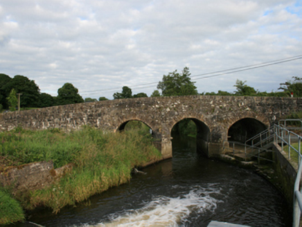
 Annesbrook BridgeBridge · 1714 yd
 Rosehill BridgeBridge · 1.1 miNorth Mullaghmore WoodWood · 1.9 miUghtyneillMountain / peak · 1.9 miSouth Mullaghmore WoodWood · 2.0 mi
.jpg/250px-Rantavan-Mullagh_(2).jpg "Photo: Wanfried-Dublin, Wikimedia Commons · CC BY 4.0") Ogham stone (present location) in MullaghOgham stone (present location) · 2.1 mi
Ogham stone (present location) in MullaghOgham stone (present location) · 2.1 mi Grave YardGraveyard · 2.4 miSally IslandIslet · 2.5 miCrow IslandIslet · 2.7 miMoynalty Steam Threshing MuseumMuseum · 2.8 mi
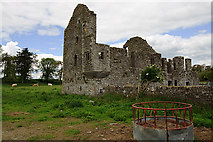 IndicatedHouse, fortified house · 4.5 mi
 Bawn in Robertstown (kells Lower By.)Bawn · 4.5 mi
More archaeology and monuments in County Meath · All of County Meath
What do you know about this place?