
What is recorded here
In pasture on slight W facing slope, on the demesne lands of Elm Park House located 290m to NNW. No surface remains visible. This is the most southerly of three earthworks (LI012-047-/049----) forming a line running NW-SE for a distance of c. 293m. The two earthworks(LI012-047-/049----) lie 270m and 166m to the NW…
Read the whole record
From the National Monuments Service (Archaeological Survey of Ireland) record LI012-050
Places near here
Photo credits
- Maker not stated on source page, www.flickr.com
- Maker not stated on source page, www.pinterest.com
- National Inventory of Architectural Heritage
- Maker not stated on source page, commons.wikimedia.org
- Mike Searle, Geograph · CC BY-SA 2.0
- Ballybrown GAA Club (official club website publisher); individual aerial photographer not named, ballybrowngaa.com
- Maker not stated on source page, narodnatribuna.info
- Bartlett, W. H. (William Henry) H. Griffiths (engraver), Wikimedia Commons · Public domain
- Maker not stated on source page, www.irishmirror.ie
 CastleCastle, unclassified · 337 yd
Explorer Tom This Castle in Elmpark has changed its name so often it’s starting to get confused about its own birthday. It’s like a…
 Church in Elmpark DemesneChurch · 337 yd
Explorer Tom Church in Elmpark Demesne nearly got famous for being mistaken for a castle, which was a bit much. The actual location…
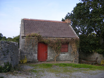 The ForgeForge/smithy · 854 yd
Explorer Tom The Forge in Ballycarney has a hidden treasure that’s definitely just a biscuit tin, but everyone swears it’s gold…
 Standing stone in Elmpark DemesneStanding stone · 926 yd
Explorer Tom Standing stone in Elmpark Demesne would be the awkward uncle at a wedding, standing there looking slightly confused and…
 Cragbeg HouseCountry house · 955 yd
Explorer Tom Cragbeg House would describe the 1800s to a teenager as 'basic' because everyone was just standing around being fancy…
 Elm Park HouseGate lodge · 1076 yd
Explorer Tom Elm Park House in Ballybrown has an unlikely celebrity friend: a very serious gate lodge that guards nothing but its…
 Ballybrown GAA pitchGAA ground · 1142 yd
 kiln1598 yd
Explorer Tom Kiln in Glebe is sitting on a hillside like a stone oven that forgot what it was baking. It’s all rugged and…
 Stone head in Glebe (pubblebrien By., Clarina Ed)Stone head · 1.1 mi
Explorer Tom Stone head in Glebe is sticking its ears out of a church wall, looking absolutely confused by modern life. A goat once…
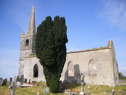 Church of Saint Philip and Saint James (Kilkeedy)Church/chapel · 1.1 mi
Explorer Tom Church of Saint Philip and Saint James (Kilkeedy) in Glebe, County Limerick is sick of being asked if it’s haunted when…
 Carrigogunnel Castle (in ruins)Castle, Anglo-Norman masonry castle · 1.7 mi
Explorer Tom Carrigogunnel Castle would spend its lotto win on a really good hat to hide from the rain. It’s been sitting on a rock…
 Páirc Antóin Ó Briain, PatrickswellGAA ground · 1.8 mi
More archaeology and monuments in County Limerick · All of County Limerick

What do you know about this place?Tap to add a comment or ask a question